C04A Brinnon, WA, USA - Earthquake Result Viewer
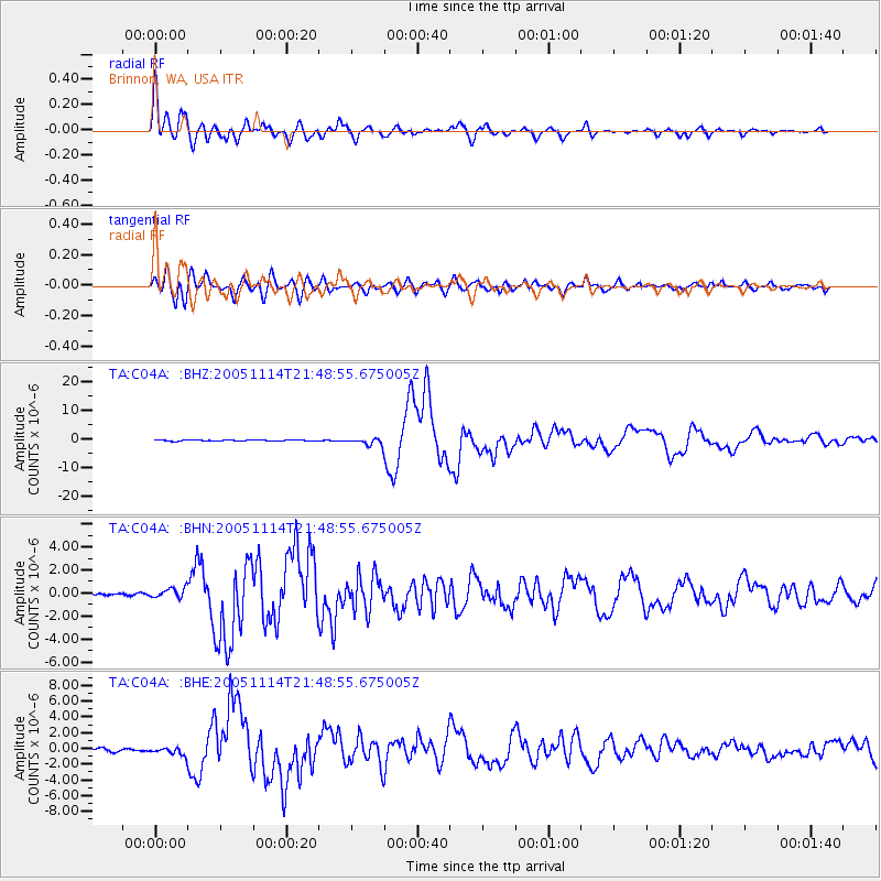
Earthquake location: Off East Coast Of Honshu, Japan
Earthquake latitude/longitude: 38.1/144.9
Earthquake time(UTC): 2005/11/14 (318) 21:38:51 GMT
Earthquake Depth: 11 km
Earthquake Magnitude: 6.7 MB, 6.8 MS, 7.0 MW, 6.9 MW
Earthquake Catalog/Contributor: WHDF/NEIC
Network: TA USArray Transportable Network (new EarthScope stations)
Station: C04A Brinnon, WA, USA
Lat/Lon: 47.72 N/122.97 W
Elevation: 53 m
Distance: 64.3 deg
Az: 48.486 deg
Baz: 298.981 deg
Ray Param: 0.059000485
Estimated Moho Depth: 10.0 km
Estimated Crust Vp/Vs: 2.02
Assumed Crust Vp: 6.566 km/s
Estimated Crust Vs: 3.259 km/s
Estimated Crust Poisson's Ratio: 0.34
Radial Match: 93.67141 %
Radial Bump: 400
Transverse Match: 86.89004 %
Transverse Bump: 400
SOD ConfigId: 2448
Insert Time: 2010-03-07 01:58:57.346 +0000
GWidth: 2.5
Max Bumps: 400
Tol: 0.001

Signal To Noise

ChannelStoNSTALTA
TA:C04A: :BHN:20051114T21:48:55.675005Z3.31778434.264464E-71.285335E-7
TA:C04A: :BHE:20051114T21:48:55.675005Z2.57829364.586163E-71.778759E-7
TA:C04A: :BHZ:20051114T21:48:55.675005Z7.0387271.2759256E-61.8127221E-7
Arrivals
Ps1.6 SECOND
PpPs4.4 SECOND
PsPs/PpSs6.0 SECOND