You are here: Home > Network List > TA - USArray Transportable Network (new EarthScope stations) Stations List
> Station C04A Brinnon, WA, USA > Earthquake Result Viewer
C04A Brinnon, WA, USA - Earthquake Result Viewer

| Earthquake location: |
South Of Fiji Islands |
| Earthquake latitude/longitude: |
-26.0/-177.5 |
| Earthquake time(UTC): |
2007/12/09 (343) 07:28:20 GMT |
| Earthquake Depth: |
152 km |
| Earthquake Magnitude: |
7.0 MB, 7.8 MW, 7.7 MW |
| Earthquake Catalog/Contributor: |
WHDF/NEIC |
|
| Network: |
TA USArray Transportable Network (new EarthScope stations) |
| Station: |
C04A Brinnon, WA, USA |
| Lat/Lon: |
47.72 N/122.97 W |
| Elevation: |
53 m |
|
| Distance: |
88.2 deg |
| Az: |
33.387 deg |
| Baz: |
227.174 deg |
| Ray Param: |
0.042404838 |
| Estimated Moho Depth: |
40.25 km |
| Estimated Crust Vp/Vs: |
1.68 |
| Assumed Crust Vp: |
6.566 km/s |
| Estimated Crust Vs: |
3.903 km/s |
| Estimated Crust Poisson's Ratio: |
0.23 |
|
| Radial Match: |
96.41878 % |
| Radial Bump: |
400 |
| Transverse Match: |
94.568 % |
| Transverse Bump: |
400 |
| SOD ConfigId: |
2564 |
| Insert Time: |
2010-03-07 01:59:02.450 +0000 |
| GWidth: |
2.5 |
| Max Bumps: |
400 |
| Tol: |
0.001 |
|
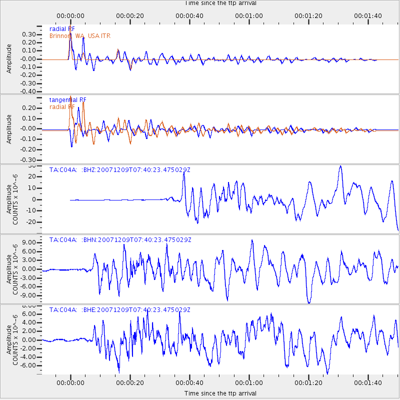
Signal To Noise
| Channel | StoN | STA | LTA |
| TA:C04A: :BHN:20071209T07:40:23.475029Z | 0.92808276 | 2.1017026E-7 | 2.2645636E-7 |
| TA:C04A: :BHE:20071209T07:40:23.475029Z | 1.8743936 | 3.1728575E-7 | 1.6927382E-7 |
| TA:C04A: :BHZ:20071209T07:40:23.475029Z | 6.5144234 | 1.1198085E-6 | 1.7189679E-7 |
| Arrivals |
| Ps | 4.3 SECOND |
| PpPs | 16 SECOND |
| PsPs/PpSs | 20 SECOND |


