
C04A Brinnon, WA, USA - Earthquake Result Viewer
| ||||||||||||||||||
| ||||||||||||||||||
| ||||||||||||||||||
|
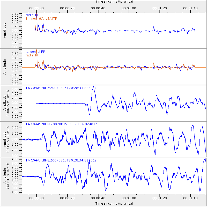
Signal To Noise
| Channel | StoN | STA | LTA |
| TA:C04A: :BHN:20070815T20:28:34.82401Z | 8.927477 | 4.3439906E-7 | 4.865866E-8 |
| TA:C04A: :BHE:20070815T20:28:34.82401Z | 17.818148 | 8.305075E-7 | 4.66102E-8 |
| TA:C04A: :BHZ:20070815T20:28:34.82401Z | 40.742508 | 1.8854278E-6 | 4.6276675E-8 |
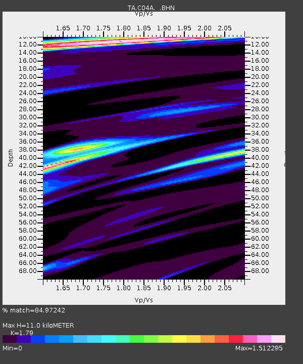
| Arrivals | |
| Ps | 1.4 SECOND |
| PpPs | 4.3 SECOND |
| PsPs/PpSs | 5.8 SECOND |

