You are here: Home > Network List > TA - USArray Transportable Network (new EarthScope stations) Stations List
> Station G21K Allakaket, AK, USA > Earthquake Result Viewer
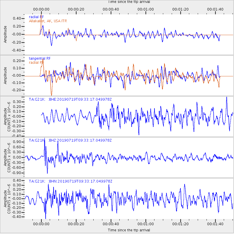
G21K Allakaket, AK, USA - Earthquake Result Viewer
*The percent match for this event was below the threshold and hence no stack was calculated.
| Earthquake location: |
Eastern Xizang-India Border Reg. |
| Earthquake latitude/longitude: |
27.7/92.8 |
| Earthquake time(UTC): |
2019/07/19 (200) 09:22:15 GMT |
| Earthquake Depth: |
17 km |
| Earthquake Magnitude: |
5.5 Mww |
| Earthquake Catalog/Contributor: |
NEIC PDE/us |
|
| Network: |
TA USArray Transportable Network (new EarthScope stations) |
| Station: |
G21K Allakaket, AK, USA |
| Lat/Lon: |
66.52 N/153.51 W |
| Elevation: |
446 m |
|
| Distance: |
73.7 deg |
| Az: |
22.483 deg |
| Baz: |
302.218 deg |
| Ray Param: |
$rayparam |
*The percent match for this event was below the threshold and hence was not used in the summary stack. |
|
| Radial Match: |
54.46458 % |
| Radial Bump: |
400 |
| Transverse Match: |
51.843307 % |
| Transverse Bump: |
400 |
| SOD ConfigId: |
19053131 |
| Insert Time: |
2019-08-02 09:27:39.200 +0000 |
| GWidth: |
2.5 |
| Max Bumps: |
400 |
| Tol: |
0.001 |
|
Signal To Noise
| Channel | StoN | STA | LTA |
| TA:G21K: :BHZ:20190719T09:33:17.049978Z | 4.180513 | 3.718319E-7 | 8.8944084E-8 |
| TA:G21K: :BHN:20190719T09:33:17.049978Z | 2.1138153 | 1.4866572E-7 | 7.0330515E-8 |
| TA:G21K: :BHE:20190719T09:33:17.049978Z | 1.6933849 | 1.3747761E-7 | 8.118509E-8 |
| Arrivals |
| Ps | |
| PpPs | |
| PsPs/PpSs | |


