F08A Pendleton, OR, USA - Earthquake Result Viewer
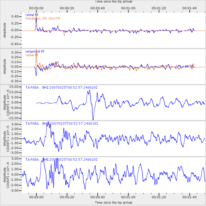
Earthquake location: Near West Coast Of Honshu, Japan
Earthquake latitude/longitude: 37.3/136.6
Earthquake time(UTC): 2007/03/25 (084) 00:41:57 GMT
Earthquake Depth: 8.0 km
Earthquake Magnitude: 6.1 MB, 6.8 MS, 6.7 MW, 6.6 MW
Earthquake Catalog/Contributor: WHDF/NEIC
Network: TA USArray Transportable Network (new EarthScope stations)
Station: F08A Pendleton, OR, USA
Lat/Lon: 45.80 N/118.78 W
Elevation: 487 m
Distance: 73.1 deg
Az: 45.027 deg
Baz: 306.295 deg
Ray Param: 0.053226918
Estimated Moho Depth: 68.0 km
Estimated Crust Vp/Vs: 2.10
Assumed Crust Vp: 6.571 km/s
Estimated Crust Vs: 3.133 km/s
Estimated Crust Poisson's Ratio: 0.35
Radial Match: 84.698654 %
Radial Bump: 400
Transverse Match: 83.96287 %
Transverse Bump: 400
SOD ConfigId: 2564
Insert Time: 2010-03-07 02:01:20.895 +0000
GWidth: 2.5
Max Bumps: 400
Tol: 0.001

Signal To Noise

ChannelStoNSTALTA
TA:F08A: :BHN:20070325T00:52:57.249016Z2.7040268.8345746E-73.2671932E-7
TA:F08A: :BHE:20070325T00:52:57.249016Z2.74186661.7060677E-66.222286E-7
TA:F08A: :BHZ:20070325T00:52:57.249016Z2.52915795.8364412E-62.307662E-6
Arrivals
Ps12 SECOND
PpPs31 SECOND
PsPs/PpSs43 SECOND