You are here: Home > Network List > IW - Intermountain West Stations List
> Station PLID Pearl Lake, Idaho, USA > Earthquake Result Viewer
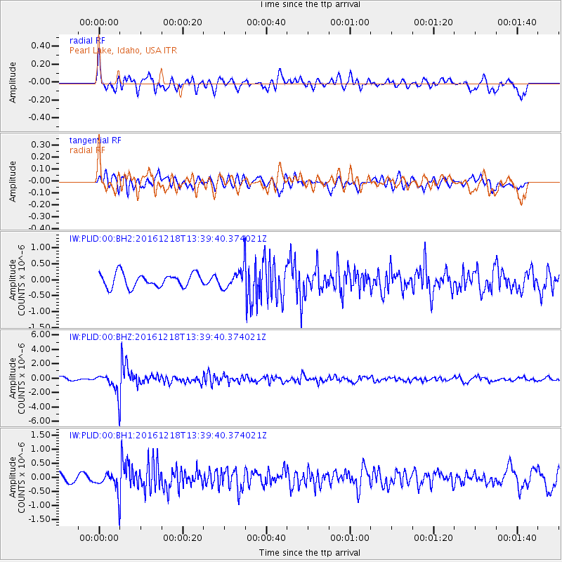
PLID Pearl Lake, Idaho, USA - Earthquake Result Viewer
*The percent match for this event was below the threshold and hence no stack was calculated.
| Earthquake location: |
Peru-Brazil Border Region |
| Earthquake latitude/longitude: |
-10.0/-71.0 |
| Earthquake time(UTC): |
2016/12/18 (353) 13:30:11 GMT |
| Earthquake Depth: |
619 km |
| Earthquake Magnitude: |
6.4 Mww |
| Earthquake Catalog/Contributor: |
NEIC PDE/us |
|
| Network: |
IW Intermountain West |
| Station: |
PLID Pearl Lake, Idaho, USA |
| Lat/Lon: |
45.09 N/116.00 W |
| Elevation: |
2164 m |
|
| Distance: |
68.2 deg |
| Az: |
327.323 deg |
| Baz: |
131.341 deg |
| Ray Param: |
$rayparam |
*The percent match for this event was below the threshold and hence was not used in the summary stack. |
|
| Radial Match: |
74.44166 % |
| Radial Bump: |
400 |
| Transverse Match: |
73.33147 % |
| Transverse Bump: |
400 |
| SOD ConfigId: |
1894071 |
| Insert Time: |
2017-01-01 13:32:56.418 +0000 |
| GWidth: |
2.5 |
| Max Bumps: |
400 |
| Tol: |
0.001 |
|
Signal To Noise
| Channel | StoN | STA | LTA |
| IW:PLID:00:BHZ:20161218T13:39:40.374021Z | 6.2568135 | 1.4040492E-6 | 2.2440322E-7 |
| IW:PLID:00:BH1:20161218T13:39:40.374021Z | 1.5666633 | 3.3653686E-7 | 2.1481124E-7 |
| IW:PLID:00:BH2:20161218T13:39:40.374021Z | 1.55941 | 3.303764E-7 | 2.1185987E-7 |
| Arrivals |
| Ps | |
| PpPs | |
| PsPs/PpSs | |


