You are here: Home > Network List > CI - Caltech Regional Seismic Network Stations List
> Station SWS Sam W. Stewart, Westmorland, CA, USA > Earthquake Result Viewer
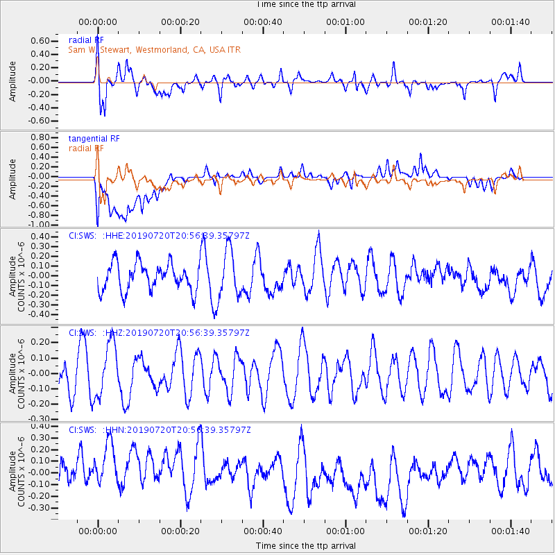
SWS Sam W. Stewart, Westmorland, CA, USA - Earthquake Result Viewer
*The percent match for this event was below the threshold and hence no stack was calculated.
| Earthquake location: |
New Britain Region, P.N.G. |
| Earthquake latitude/longitude: |
-6.0/149.5 |
| Earthquake time(UTC): |
2019/07/20 (201) 20:43:44 GMT |
| Earthquake Depth: |
60 km |
| Earthquake Magnitude: |
5.6 Mww |
| Earthquake Catalog/Contributor: |
NEIC PDE/us |
|
| Network: |
CI Caltech Regional Seismic Network |
| Station: |
SWS Sam W. Stewart, Westmorland, CA, USA |
| Lat/Lon: |
32.94 N/115.80 W |
| Elevation: |
140 m |
|
| Distance: |
97.2 deg |
| Az: |
57.636 deg |
| Baz: |
267.495 deg |
| Ray Param: |
$rayparam |
*The percent match for this event was below the threshold and hence was not used in the summary stack. |
|
| Radial Match: |
65.21252 % |
| Radial Bump: |
400 |
| Transverse Match: |
53.347893 % |
| Transverse Bump: |
400 |
| SOD ConfigId: |
19053131 |
| Insert Time: |
2019-08-03 20:46:45.199 +0000 |
| GWidth: |
2.5 |
| Max Bumps: |
400 |
| Tol: |
0.001 |
|
Signal To Noise
| Channel | StoN | STA | LTA |
| CI:SWS: :HHZ:20190720T20:56:39.35797Z | 1.5536015 | 1.7767526E-7 | 1.14363466E-7 |
| CI:SWS: :HHN:20190720T20:56:39.35797Z | 1.2982371 | 3.5214026E-7 | 2.7124494E-7 |
| CI:SWS: :HHE:20190720T20:56:39.35797Z | 1.7213964 | 2.3798283E-7 | 1.3824987E-7 |
| Arrivals |
| Ps | |
| PpPs | |
| PsPs/PpSs | |


