You are here: Home > Network List > NE - New England Seismic Network Stations List
> Station EMMW Machias, ME, USA > Earthquake Result Viewer
EMMW Machias, ME, USA - Earthquake Result Viewer
*The percent match for this event was below the threshold and hence no stack was calculated.
| Earthquake location: |
Peru-Brazil Border Region |
| Earthquake latitude/longitude: |
-10.0/-71.0 |
| Earthquake time(UTC): |
2016/12/18 (353) 13:30:11 GMT |
| Earthquake Depth: |
619 km |
| Earthquake Magnitude: |
6.4 Mww |
| Earthquake Catalog/Contributor: |
NEIC PDE/us |
|
| Network: |
NE New England Seismic Network |
| Station: |
EMMW Machias, ME, USA |
| Lat/Lon: |
44.71 N/67.46 W |
| Elevation: |
35 m |
|
| Distance: |
54.5 deg |
| Az: |
3.072 deg |
| Baz: |
184.246 deg |
| Ray Param: |
$rayparam |
*The percent match for this event was below the threshold and hence was not used in the summary stack. |
|
| Radial Match: |
58.532116 % |
| Radial Bump: |
366 |
| Transverse Match: |
59.73369 % |
| Transverse Bump: |
400 |
| SOD ConfigId: |
1894071 |
| Insert Time: |
2017-01-01 13:33:13.482 +0000 |
| GWidth: |
2.5 |
| Max Bumps: |
400 |
| Tol: |
0.001 |
|
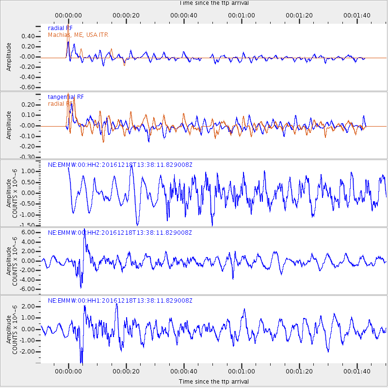
Signal To Noise
| Channel | StoN | STA | LTA |
| NE:EMMW:00:HHZ:20161218T13:38:11.829008Z | 3.4009888 | 1.915757E-6 | 5.632941E-7 |
| NE:EMMW:00:HH1:20161218T13:38:11.829008Z | 2.7924984 | 1.0281058E-6 | 3.6816704E-7 |
| NE:EMMW:00:HH2:20161218T13:38:11.829008Z | 0.9076501 | 5.2550365E-7 | 5.789716E-7 |
| Arrivals |
| Ps | |
| PpPs | |
| PsPs/PpSs | |


