You are here: Home > Network List > TA - USArray Transportable Network (new EarthScope stations) Stations List
> Station J26L Joseph Creek, AK, USA > Earthquake Result Viewer
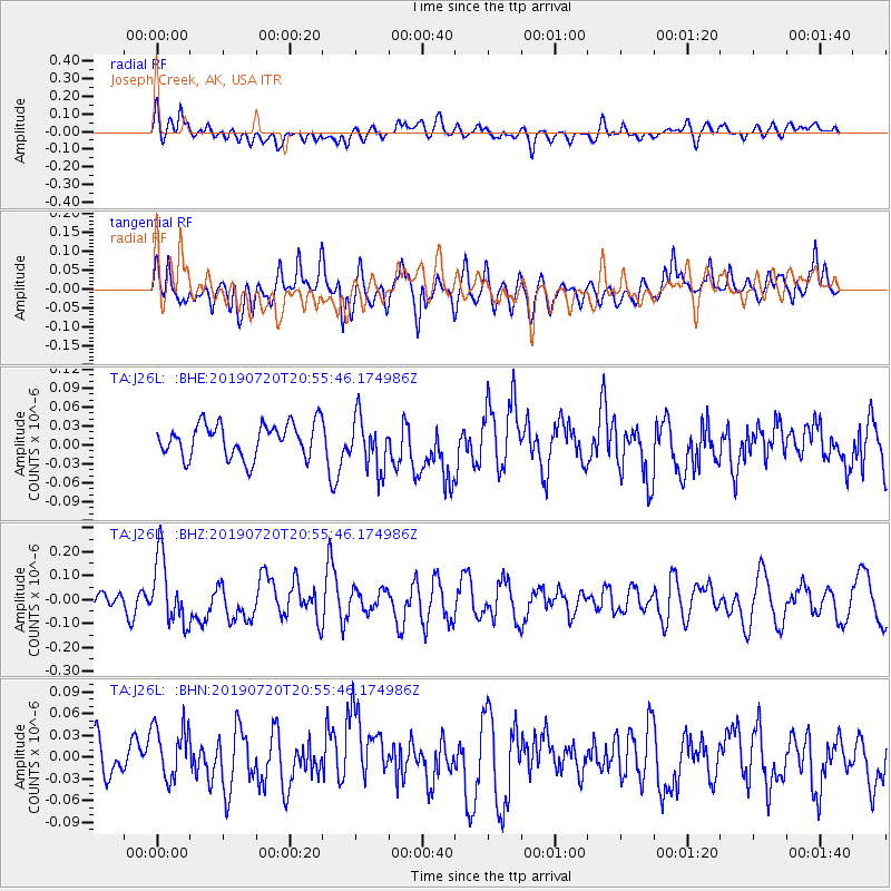
J26L Joseph Creek, AK, USA - Earthquake Result Viewer
*The percent match for this event was below the threshold and hence no stack was calculated.
| Earthquake location: |
New Britain Region, P.N.G. |
| Earthquake latitude/longitude: |
-6.0/149.5 |
| Earthquake time(UTC): |
2019/07/20 (201) 20:43:44 GMT |
| Earthquake Depth: |
60 km |
| Earthquake Magnitude: |
5.6 Mww |
| Earthquake Catalog/Contributor: |
NEIC PDE/us |
|
| Network: |
TA USArray Transportable Network (new EarthScope stations) |
| Station: |
J26L Joseph Creek, AK, USA |
| Lat/Lon: |
64.50 N/143.56 W |
| Elevation: |
1144 m |
|
| Distance: |
85.7 deg |
| Az: |
23.538 deg |
| Baz: |
246.58 deg |
| Ray Param: |
$rayparam |
*The percent match for this event was below the threshold and hence was not used in the summary stack. |
|
| Radial Match: |
56.6393 % |
| Radial Bump: |
400 |
| Transverse Match: |
48.67062 % |
| Transverse Bump: |
400 |
| SOD ConfigId: |
19053131 |
| Insert Time: |
2019-08-03 20:48:56.388 +0000 |
| GWidth: |
2.5 |
| Max Bumps: |
400 |
| Tol: |
0.001 |
|
Signal To Noise
| Channel | StoN | STA | LTA |
| TA:J26L: :BHZ:20190720T20:55:46.174986Z | 2.4785564 | 1.398628E-7 | 5.6429137E-8 |
| TA:J26L: :BHN:20190720T20:55:46.174986Z | 1.4515783 | 3.8407965E-8 | 2.645945E-8 |
| TA:J26L: :BHE:20190720T20:55:46.174986Z | 1.5640922 | 4.1570758E-8 | 2.6578201E-8 |
| Arrivals |
| Ps | |
| PpPs | |
| PsPs/PpSs | |


