You are here: Home > Network List > US - United States National Seismic Network Stations List
> Station AMTX Amarillo, Texas, USA > Earthquake Result Viewer
AMTX Amarillo, Texas, USA - Earthquake Result Viewer
*The percent match for this event was below the threshold and hence no stack was calculated.
| Earthquake location: |
Peru-Brazil Border Region |
| Earthquake latitude/longitude: |
-10.0/-71.0 |
| Earthquake time(UTC): |
2016/12/18 (353) 13:30:11 GMT |
| Earthquake Depth: |
619 km |
| Earthquake Magnitude: |
6.4 Mww |
| Earthquake Catalog/Contributor: |
NEIC PDE/us |
|
| Network: |
US United States National Seismic Network |
| Station: |
AMTX Amarillo, Texas, USA |
| Lat/Lon: |
34.53 N/101.41 W |
| Elevation: |
1010 m |
|
| Distance: |
52.8 deg |
| Az: |
328.337 deg |
| Baz: |
141.22 deg |
| Ray Param: |
$rayparam |
*The percent match for this event was below the threshold and hence was not used in the summary stack. |
|
| Radial Match: |
60.142975 % |
| Radial Bump: |
400 |
| Transverse Match: |
55.454784 % |
| Transverse Bump: |
400 |
| SOD ConfigId: |
1894071 |
| Insert Time: |
2017-01-01 13:34:23.219 +0000 |
| GWidth: |
2.5 |
| Max Bumps: |
400 |
| Tol: |
0.001 |
|
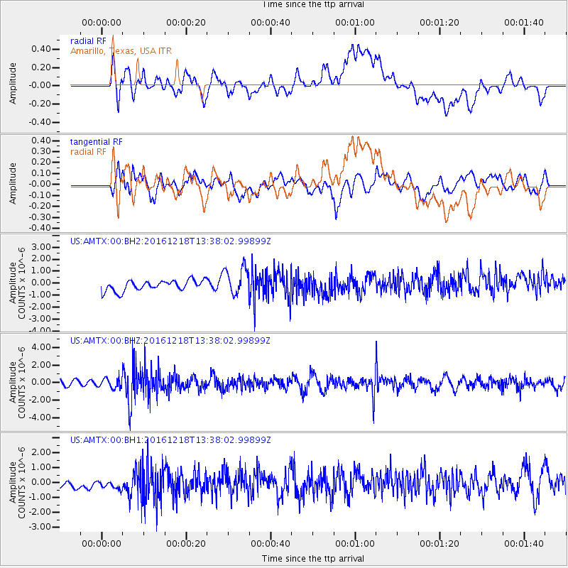
Signal To Noise
| Channel | StoN | STA | LTA |
| US:AMTX:00:BHZ:20161218T13:38:02.99899Z | 1.0989376 | 5.4578794E-7 | 4.966505E-7 |
| US:AMTX:00:BH1:20161218T13:38:02.99899Z | 0.7632041 | 5.3480824E-7 | 7.007408E-7 |
| US:AMTX:00:BH2:20161218T13:38:02.99899Z | 1.943894 | 8.5662197E-7 | 4.406732E-7 |
| Arrivals |
| Ps | |
| PpPs | |
| PsPs/PpSs | |


