You are here: Home > Network List > US - United States National Seismic Network Stations List
> Station EGMT Eagleton, Montana, USA > Earthquake Result Viewer
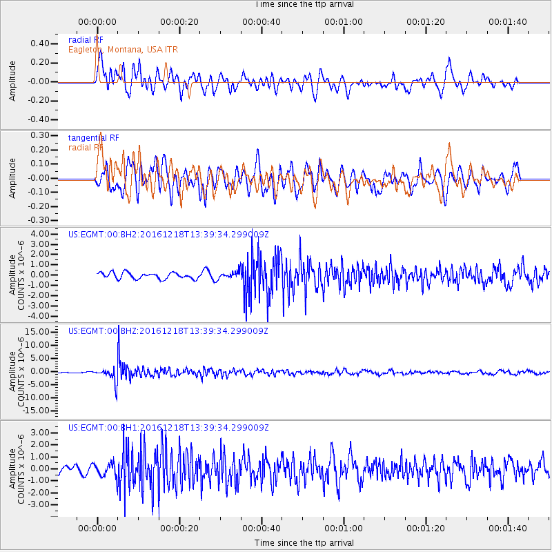
EGMT Eagleton, Montana, USA - Earthquake Result Viewer
*The percent match for this event was below the threshold and hence no stack was calculated.
| Earthquake location: |
Peru-Brazil Border Region |
| Earthquake latitude/longitude: |
-10.0/-71.0 |
| Earthquake time(UTC): |
2016/12/18 (353) 13:30:11 GMT |
| Earthquake Depth: |
619 km |
| Earthquake Magnitude: |
6.4 Mww |
| Earthquake Catalog/Contributor: |
NEIC PDE/us |
|
| Network: |
US United States National Seismic Network |
| Station: |
EGMT Eagleton, Montana, USA |
| Lat/Lon: |
48.02 N/109.75 W |
| Elevation: |
1055 m |
|
| Distance: |
67.2 deg |
| Az: |
332.853 deg |
| Baz: |
137.967 deg |
| Ray Param: |
$rayparam |
*The percent match for this event was below the threshold and hence was not used in the summary stack. |
|
| Radial Match: |
74.253456 % |
| Radial Bump: |
400 |
| Transverse Match: |
71.683464 % |
| Transverse Bump: |
400 |
| SOD ConfigId: |
1894071 |
| Insert Time: |
2017-01-01 13:34:45.705 +0000 |
| GWidth: |
2.5 |
| Max Bumps: |
400 |
| Tol: |
0.001 |
|
Signal To Noise
| Channel | StoN | STA | LTA |
| US:EGMT:00:BHZ:20161218T13:39:34.299009Z | 15.770177 | 2.966847E-6 | 1.8813023E-7 |
| US:EGMT:00:BH1:20161218T13:39:34.299009Z | 1.8642528 | 5.2174556E-7 | 2.7986846E-7 |
| US:EGMT:00:BH2:20161218T13:39:34.299009Z | 1.1793057 | 3.5278475E-7 | 2.9914614E-7 |
| Arrivals |
| Ps | |
| PpPs | |
| PsPs/PpSs | |


