You are here: Home > Network List > TA - USArray Transportable Network (new EarthScope stations) Stations List
> Station F20K Avaraart Lake, AK, USA > Earthquake Result Viewer
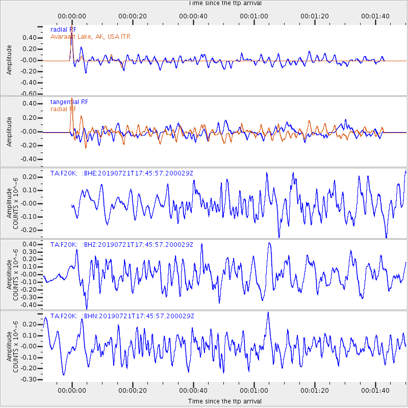
F20K Avaraart Lake, AK, USA - Earthquake Result Viewer
*The percent match for this event was below the threshold and hence no stack was calculated.
| Earthquake location: |
South Of Mariana Islands |
| Earthquake latitude/longitude: |
12.3/144.4 |
| Earthquake time(UTC): |
2019/07/21 (202) 17:35:38 GMT |
| Earthquake Depth: |
48 km |
| Earthquake Magnitude: |
5.5 mb |
| Earthquake Catalog/Contributor: |
NEIC PDE/us |
|
| Network: |
TA USArray Transportable Network (new EarthScope stations) |
| Station: |
F20K Avaraart Lake, AK, USA |
| Lat/Lon: |
67.05 N/155.73 W |
| Elevation: |
136 m |
|
| Distance: |
67.3 deg |
| Az: |
21.577 deg |
| Baz: |
246.437 deg |
| Ray Param: |
$rayparam |
*The percent match for this event was below the threshold and hence was not used in the summary stack. |
|
| Radial Match: |
55.174713 % |
| Radial Bump: |
400 |
| Transverse Match: |
35.0544 % |
| Transverse Bump: |
400 |
| SOD ConfigId: |
19053131 |
| Insert Time: |
2019-08-04 17:41:44.131 +0000 |
| GWidth: |
2.5 |
| Max Bumps: |
400 |
| Tol: |
0.001 |
|
Signal To Noise
| Channel | StoN | STA | LTA |
| TA:F20K: :BHZ:20190721T17:45:57.200029Z | 2.7535794 | 1.9362463E-7 | 7.0317434E-8 |
| TA:F20K: :BHN:20190721T17:45:57.200029Z | 0.65881634 | 1.0770668E-7 | 1.6348514E-7 |
| TA:F20K: :BHE:20190721T17:45:57.200029Z | 0.97376573 | 6.618667E-8 | 6.7969815E-8 |
| Arrivals |
| Ps | |
| PpPs | |
| PsPs/PpSs | |


