You are here: Home > Network List > TA - USArray Transportable Network (new EarthScope stations) Stations List
> Station J26L Joseph Creek, AK, USA > Earthquake Result Viewer
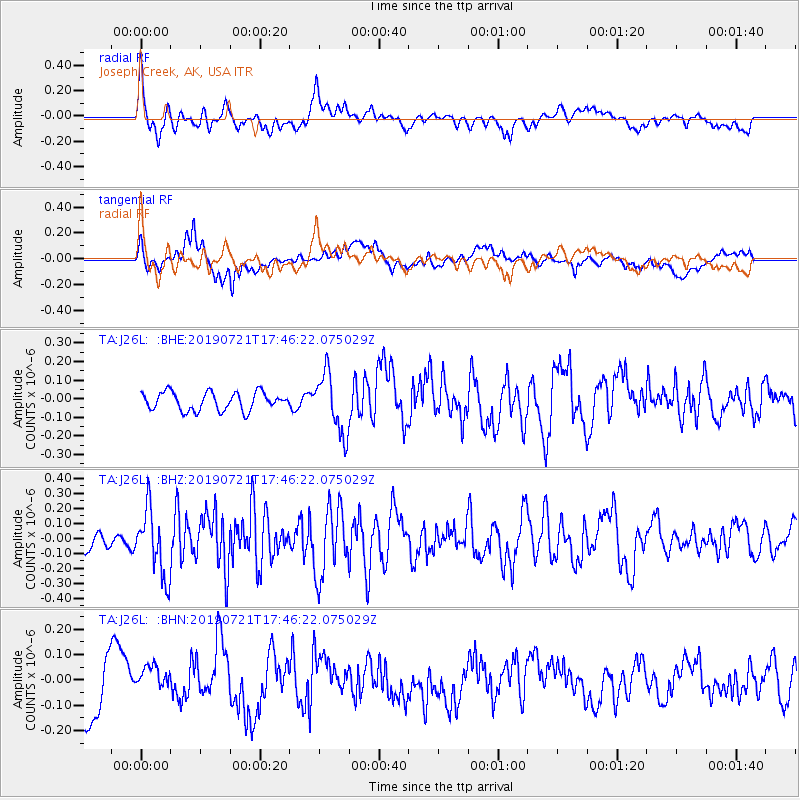
J26L Joseph Creek, AK, USA - Earthquake Result Viewer
*The percent match for this event was below the threshold and hence no stack was calculated.
| Earthquake location: |
South Of Mariana Islands |
| Earthquake latitude/longitude: |
12.3/144.4 |
| Earthquake time(UTC): |
2019/07/21 (202) 17:35:38 GMT |
| Earthquake Depth: |
48 km |
| Earthquake Magnitude: |
5.5 mb |
| Earthquake Catalog/Contributor: |
NEIC PDE/us |
|
| Network: |
TA USArray Transportable Network (new EarthScope stations) |
| Station: |
J26L Joseph Creek, AK, USA |
| Lat/Lon: |
64.50 N/143.56 W |
| Elevation: |
1144 m |
|
| Distance: |
71.3 deg |
| Az: |
25.765 deg |
| Baz: |
259.008 deg |
| Ray Param: |
$rayparam |
*The percent match for this event was below the threshold and hence was not used in the summary stack. |
|
| Radial Match: |
68.82982 % |
| Radial Bump: |
400 |
| Transverse Match: |
49.205746 % |
| Transverse Bump: |
400 |
| SOD ConfigId: |
19053131 |
| Insert Time: |
2019-08-04 17:42:09.707 +0000 |
| GWidth: |
2.5 |
| Max Bumps: |
400 |
| Tol: |
0.001 |
|
Signal To Noise
| Channel | StoN | STA | LTA |
| TA:J26L: :BHZ:20190721T17:46:22.075029Z | 3.3071053 | 2.2181747E-7 | 6.7072996E-8 |
| TA:J26L: :BHN:20190721T17:46:22.075029Z | 0.6120438 | 7.8608934E-8 | 1.2843677E-7 |
| TA:J26L: :BHE:20190721T17:46:22.075029Z | 3.3027875 | 1.6050356E-7 | 4.859639E-8 |
| Arrivals |
| Ps | |
| PpPs | |
| PsPs/PpSs | |


