You are here: Home > Network List > TA - USArray Transportable Network (new EarthScope stations) Stations List
> Station M31M Drury Creek, Yukon, CA > Earthquake Result Viewer
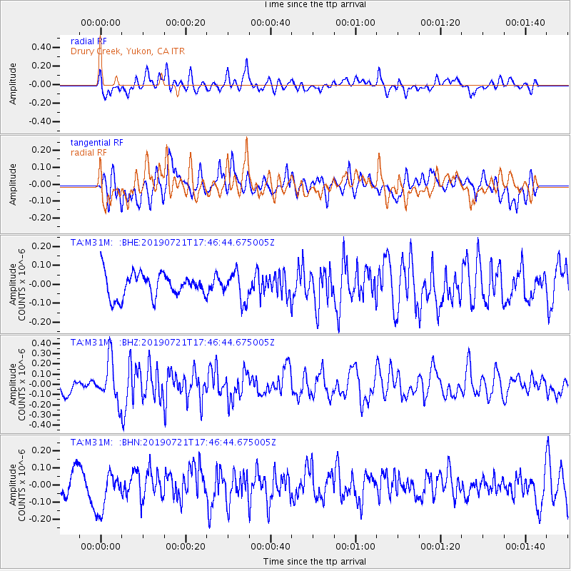
M31M Drury Creek, Yukon, CA - Earthquake Result Viewer
*The percent match for this event was below the threshold and hence no stack was calculated.
| Earthquake location: |
South Of Mariana Islands |
| Earthquake latitude/longitude: |
12.3/144.4 |
| Earthquake time(UTC): |
2019/07/21 (202) 17:35:38 GMT |
| Earthquake Depth: |
48 km |
| Earthquake Magnitude: |
5.5 mb |
| Earthquake Catalog/Contributor: |
NEIC PDE/us |
|
| Network: |
TA USArray Transportable Network (new EarthScope stations) |
| Station: |
M31M Drury Creek, Yukon, CA |
| Lat/Lon: |
62.20 N/134.39 W |
| Elevation: |
639 m |
|
| Distance: |
75.1 deg |
| Az: |
28.64 deg |
| Baz: |
268.031 deg |
| Ray Param: |
$rayparam |
*The percent match for this event was below the threshold and hence was not used in the summary stack. |
|
| Radial Match: |
53.854572 % |
| Radial Bump: |
400 |
| Transverse Match: |
54.037525 % |
| Transverse Bump: |
400 |
| SOD ConfigId: |
19053131 |
| Insert Time: |
2019-08-04 17:42:26.456 +0000 |
| GWidth: |
2.5 |
| Max Bumps: |
400 |
| Tol: |
0.001 |
|
Signal To Noise
| Channel | StoN | STA | LTA |
| TA:M31M: :BHZ:20190721T17:46:44.675005Z | 3.4583876 | 2.1122825E-7 | 6.107709E-8 |
| TA:M31M: :BHN:20190721T17:46:44.675005Z | 1.529445 | 1.16504886E-7 | 7.6174615E-8 |
| TA:M31M: :BHE:20190721T17:46:44.675005Z | 1.2189656 | 7.648765E-8 | 6.274799E-8 |
| Arrivals |
| Ps | |
| PpPs | |
| PsPs/PpSs | |


