You are here: Home > Network List > TA - USArray Transportable Network (new EarthScope stations) Stations List
> Station R31K City Hall, Gustavus, AK, USA > Earthquake Result Viewer
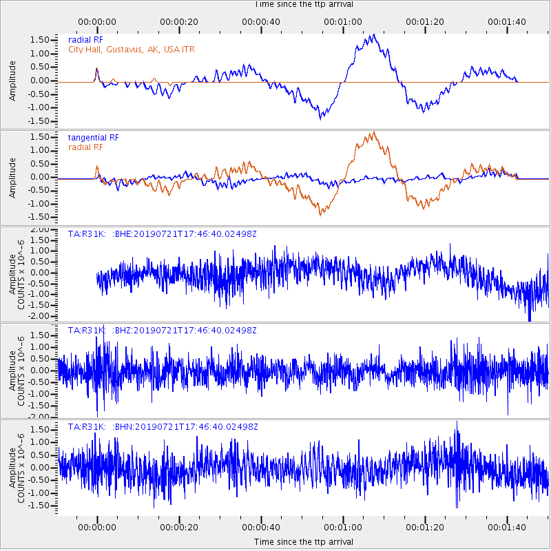
R31K City Hall, Gustavus, AK, USA - Earthquake Result Viewer
*The percent match for this event was below the threshold and hence no stack was calculated.
| Earthquake location: |
South Of Mariana Islands |
| Earthquake latitude/longitude: |
12.3/144.4 |
| Earthquake time(UTC): |
2019/07/21 (202) 17:35:38 GMT |
| Earthquake Depth: |
48 km |
| Earthquake Magnitude: |
5.5 mb |
| Earthquake Catalog/Contributor: |
NEIC PDE/us |
|
| Network: |
TA USArray Transportable Network (new EarthScope stations) |
| Station: |
R31K City Hall, Gustavus, AK, USA |
| Lat/Lon: |
58.41 N/135.74 W |
| Elevation: |
15 m |
|
| Distance: |
74.3 deg |
| Az: |
32.553 deg |
| Baz: |
267.891 deg |
| Ray Param: |
$rayparam |
*The percent match for this event was below the threshold and hence was not used in the summary stack. |
|
| Radial Match: |
48.253372 % |
| Radial Bump: |
400 |
| Transverse Match: |
21.938454 % |
| Transverse Bump: |
400 |
| SOD ConfigId: |
19053131 |
| Insert Time: |
2019-08-04 17:42:47.490 +0000 |
| GWidth: |
2.5 |
| Max Bumps: |
400 |
| Tol: |
0.001 |
|
Signal To Noise
| Channel | StoN | STA | LTA |
| TA:R31K: :BHZ:20190721T17:46:40.02498Z | 2.0263314 | 7.300244E-7 | 3.60269E-7 |
| TA:R31K: :BHN:20190721T17:46:40.02498Z | 1.6750921 | 5.6184155E-7 | 3.3540934E-7 |
| TA:R31K: :BHE:20190721T17:46:40.02498Z | 1.8112264 | 5.8036386E-7 | 3.204259E-7 |
| Arrivals |
| Ps | |
| PpPs | |
| PsPs/PpSs | |


