You are here: Home > Network List > US - United States National Seismic Network Stations List
> Station ELK Elko, Nevada, USA > Earthquake Result Viewer
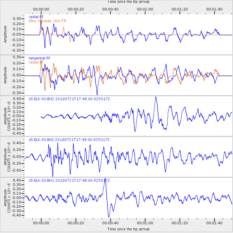
ELK Elko, Nevada, USA - Earthquake Result Viewer
*The percent match for this event was below the threshold and hence no stack was calculated.
| Earthquake location: |
South Of Mariana Islands |
| Earthquake latitude/longitude: |
12.3/144.4 |
| Earthquake time(UTC): |
2019/07/21 (202) 17:35:38 GMT |
| Earthquake Depth: |
48 km |
| Earthquake Magnitude: |
5.5 mb |
| Earthquake Catalog/Contributor: |
NEIC PDE/us |
|
| Network: |
US United States National Seismic Network |
| Station: |
ELK Elko, Nevada, USA |
| Lat/Lon: |
40.74 N/115.24 W |
| Elevation: |
2210 m |
|
| Distance: |
89.8 deg |
| Az: |
48.367 deg |
| Baz: |
285.929 deg |
| Ray Param: |
$rayparam |
*The percent match for this event was below the threshold and hence was not used in the summary stack. |
|
| Radial Match: |
59.08088 % |
| Radial Bump: |
400 |
| Transverse Match: |
49.47965 % |
| Transverse Bump: |
400 |
| SOD ConfigId: |
19053131 |
| Insert Time: |
2019-08-04 17:43:04.310 +0000 |
| GWidth: |
2.5 |
| Max Bumps: |
400 |
| Tol: |
0.001 |
|
Signal To Noise
| Channel | StoN | STA | LTA |
| US:ELK:00:BHZ:20190721T17:48:00.625017Z | 1.566122 | 1.1476471E-7 | 7.3279544E-8 |
| US:ELK:00:BH1:20190721T17:48:00.625017Z | 1.4403559 | 4.302347E-8 | 2.9870026E-8 |
| US:ELK:00:BH2:20190721T17:48:00.625017Z | 1.4147476 | 4.1206434E-8 | 2.912635E-8 |
| Arrivals |
| Ps | |
| PpPs | |
| PsPs/PpSs | |


