You are here: Home > Network List > US - United States National Seismic Network Stations List
> Station MCWV Mont Chateau, West Virginia, USA > Earthquake Result Viewer
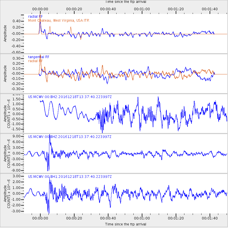
MCWV Mont Chateau, West Virginia, USA - Earthquake Result Viewer
*The percent match for this event was below the threshold and hence no stack was calculated.
| Earthquake location: |
Peru-Brazil Border Region |
| Earthquake latitude/longitude: |
-10.0/-71.0 |
| Earthquake time(UTC): |
2016/12/18 (353) 13:30:11 GMT |
| Earthquake Depth: |
619 km |
| Earthquake Magnitude: |
6.4 Mww |
| Earthquake Catalog/Contributor: |
NEIC PDE/us |
|
| Network: |
US United States National Seismic Network |
| Station: |
MCWV Mont Chateau, West Virginia, USA |
| Lat/Lon: |
39.66 N/79.85 W |
| Elevation: |
280 m |
|
| Distance: |
50.1 deg |
| Az: |
351.058 deg |
| Baz: |
168.56 deg |
| Ray Param: |
$rayparam |
*The percent match for this event was below the threshold and hence was not used in the summary stack. |
|
| Radial Match: |
56.95798 % |
| Radial Bump: |
400 |
| Transverse Match: |
41.697605 % |
| Transverse Bump: |
400 |
| SOD ConfigId: |
1894071 |
| Insert Time: |
2017-01-01 13:35:11.958 +0000 |
| GWidth: |
2.5 |
| Max Bumps: |
400 |
| Tol: |
0.001 |
|
Signal To Noise
| Channel | StoN | STA | LTA |
| US:MCWV:00:BHZ:20161218T13:37:40.223997Z | 3.8461251 | 2.421008E-6 | 6.294668E-7 |
| US:MCWV:00:BH1:20161218T13:37:40.223997Z | 1.6048213 | 8.981371E-7 | 5.596493E-7 |
| US:MCWV:00:BH2:20161218T13:37:40.223997Z | 1.5169897 | 7.930089E-7 | 5.227517E-7 |
| Arrivals |
| Ps | |
| PpPs | |
| PsPs/PpSs | |


