You are here: Home > Network List > TA - USArray Transportable Network (new EarthScope stations) Stations List
> Station J26L Joseph Creek, AK, USA > Earthquake Result Viewer
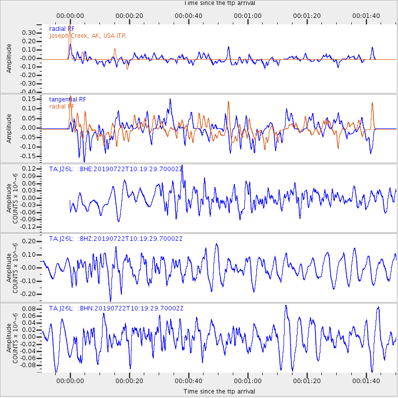
J26L Joseph Creek, AK, USA - Earthquake Result Viewer
*The percent match for this event was below the threshold and hence no stack was calculated.
| Earthquake location: |
Irian Jaya Region, Indonesia |
| Earthquake latitude/longitude: |
-3.4/131.0 |
| Earthquake time(UTC): |
2019/07/22 (203) 10:06:56 GMT |
| Earthquake Depth: |
10 km |
| Earthquake Magnitude: |
5.5 Mww |
| Earthquake Catalog/Contributor: |
NEIC PDE/us |
|
| Network: |
TA USArray Transportable Network (new EarthScope stations) |
| Station: |
J26L Joseph Creek, AK, USA |
| Lat/Lon: |
64.50 N/143.56 W |
| Elevation: |
1144 m |
|
| Distance: |
91.1 deg |
| Az: |
25.566 deg |
| Baz: |
264.428 deg |
| Ray Param: |
$rayparam |
*The percent match for this event was below the threshold and hence was not used in the summary stack. |
|
| Radial Match: |
39.3295 % |
| Radial Bump: |
400 |
| Transverse Match: |
45.811115 % |
| Transverse Bump: |
400 |
| SOD ConfigId: |
19053131 |
| Insert Time: |
2019-08-05 10:10:12.851 +0000 |
| GWidth: |
2.5 |
| Max Bumps: |
400 |
| Tol: |
0.001 |
|
Signal To Noise
| Channel | StoN | STA | LTA |
| TA:J26L: :BHZ:20190722T10:19:29.70002Z | 1.2947769 | 6.2270566E-8 | 4.8093668E-8 |
| TA:J26L: :BHN:20190722T10:19:29.70002Z | 1.4419904 | 5.2493615E-8 | 3.640358E-8 |
| TA:J26L: :BHE:20190722T10:19:29.70002Z | 1.3871263 | 4.9951826E-8 | 3.6011013E-8 |
| Arrivals |
| Ps | |
| PpPs | |
| PsPs/PpSs | |


