H04A Detroit Lake, OR, USA - Earthquake Result Viewer
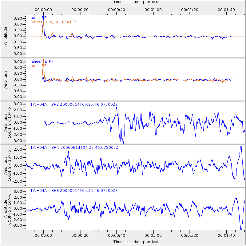
Earthquake location: Rat Islands, Aleutian Islands
Earthquake latitude/longitude: 51.8/177.1
Earthquake time(UTC): 2006/06/14 (165) 04:18:42 GMT
Earthquake Depth: 14 km
Earthquake Magnitude: 5.9 MB, 6.4 MS, 6.4 MW, 6.4 MW
Earthquake Catalog/Contributor: WHDF/NEIC
Network: TA USArray Transportable Network (new EarthScope stations)
Station: H04A Detroit Lake, OR, USA
Lat/Lon: 44.68 N/122.19 W
Elevation: 652 m
Distance: 40.0 deg
Az: 75.369 deg
Baz: 302.525 deg
Ray Param: 0.07462302
Estimated Moho Depth: 38.5 km
Estimated Crust Vp/Vs: 1.92
Assumed Crust Vp: 6.566 km/s
Estimated Crust Vs: 3.411 km/s
Estimated Crust Poisson's Ratio: 0.32
Radial Match: 88.46541 %
Radial Bump: 277
Transverse Match: 55.669567 %
Transverse Bump: 400
SOD ConfigId: 5745
Insert Time: 2010-03-07 02:07:49.249 +0000
GWidth: 2.5
Max Bumps: 400
Tol: 0.001

Signal To Noise

ChannelStoNSTALTA
TA:H04A: :BHN:20060614T04:25:46.075002Z1.24107072.1402055E-71.7244831E-7
TA:H04A: :BHE:20060614T04:25:46.075002Z2.20984552.9098555E-71.3167688E-7
TA:H04A: :BHZ:20060614T04:25:46.075002Z2.85741424.6026148E-71.6107622E-7
Arrivals
Ps5.8 SECOND
PpPs16 SECOND
PsPs/PpSs22 SECOND