You are here: Home > Network List > UU - University of Utah Regional Network Stations List
> Station FOR4 Blundell West, UT, USA > Earthquake Result Viewer
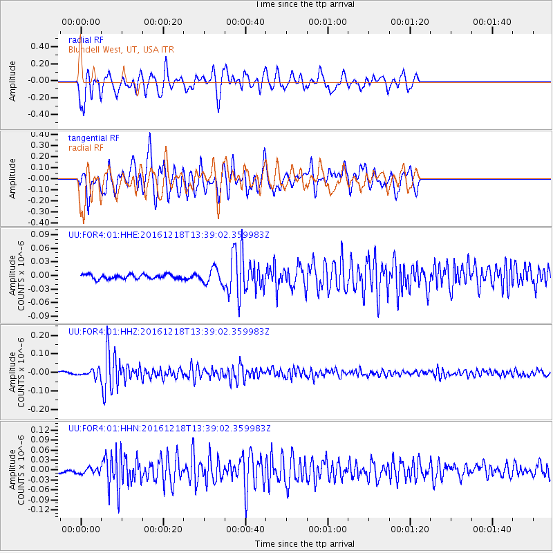
FOR4 Blundell West, UT, USA - Earthquake Result Viewer
*The percent match for this event was below the threshold and hence no stack was calculated.
| Earthquake location: |
Peru-Brazil Border Region |
| Earthquake latitude/longitude: |
-10.0/-71.0 |
| Earthquake time(UTC): |
2016/12/18 (353) 13:30:11 GMT |
| Earthquake Depth: |
619 km |
| Earthquake Magnitude: |
6.4 Mww |
| Earthquake Catalog/Contributor: |
NEIC PDE/us |
|
| Network: |
UU University of Utah Regional Network |
| Station: |
FOR4 Blundell West, UT, USA |
| Lat/Lon: |
38.50 N/112.90 W |
| Elevation: |
1657 m |
|
| Distance: |
62.1 deg |
| Az: |
323.597 deg |
| Baz: |
131.835 deg |
| Ray Param: |
$rayparam |
*The percent match for this event was below the threshold and hence was not used in the summary stack. |
|
| Radial Match: |
66.28087 % |
| Radial Bump: |
400 |
| Transverse Match: |
81.872826 % |
| Transverse Bump: |
400 |
| SOD ConfigId: |
1894071 |
| Insert Time: |
2017-01-01 13:36:22.470 +0000 |
| GWidth: |
2.5 |
| Max Bumps: |
400 |
| Tol: |
0.001 |
|
Signal To Noise
| Channel | StoN | STA | LTA |
| UU:FOR4:01:HHZ:20161218T13:39:02.359983Z | 2.6841295 | 1.831507E-8 | 6.8234676E-9 |
| UU:FOR4:01:HHN:20161218T13:39:02.359983Z | 1.3540149 | 8.562444E-9 | 6.3237446E-9 |
| UU:FOR4:01:HHE:20161218T13:39:02.359983Z | 3.5725021 | 1.7226926E-8 | 4.82209E-9 |
| Arrivals |
| Ps | |
| PpPs | |
| PsPs/PpSs | |


