You are here: Home > Network List > TA - USArray Transportable Network (new EarthScope stations) Stations List
> Station M16K Timber Creek, AK, USA > Earthquake Result Viewer
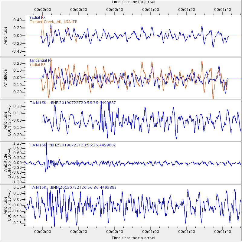
M16K Timber Creek, AK, USA - Earthquake Result Viewer
*The percent match for this event was below the threshold and hence no stack was calculated.
| Earthquake location: |
Northeast Of Taiwan |
| Earthquake latitude/longitude: |
25.3/124.4 |
| Earthquake time(UTC): |
2019/07/22 (203) 20:46:58 GMT |
| Earthquake Depth: |
100 km |
| Earthquake Magnitude: |
5.1 Mww |
| Earthquake Catalog/Contributor: |
NEIC PDE/us |
|
| Network: |
TA USArray Transportable Network (new EarthScope stations) |
| Station: |
M16K Timber Creek, AK, USA |
| Lat/Lon: |
61.02 N/158.96 W |
| Elevation: |
394 m |
|
| Distance: |
61.8 deg |
| Az: |
32.518 deg |
| Baz: |
271.584 deg |
| Ray Param: |
$rayparam |
*The percent match for this event was below the threshold and hence was not used in the summary stack. |
|
| Radial Match: |
56.141754 % |
| Radial Bump: |
400 |
| Transverse Match: |
59.063828 % |
| Transverse Bump: |
400 |
| SOD ConfigId: |
19053131 |
| Insert Time: |
2019-08-05 20:53:50.728 +0000 |
| GWidth: |
2.5 |
| Max Bumps: |
400 |
| Tol: |
0.001 |
|
Signal To Noise
| Channel | StoN | STA | LTA |
| TA:M16K: :BHZ:20190722T20:56:36.449988Z | 5.6676426 | 3.0780961E-7 | 5.4309993E-8 |
| TA:M16K: :BHN:20190722T20:56:36.449988Z | 1.2870299 | 6.1715525E-8 | 4.79519E-8 |
| TA:M16K: :BHE:20190722T20:56:36.449988Z | 1.1994759 | 9.7003785E-8 | 8.087181E-8 |
| Arrivals |
| Ps | |
| PpPs | |
| PsPs/PpSs | |


