You are here: Home > Network List > TA - USArray Transportable Network (new EarthScope stations) Stations List
> Station R33M Jennings River, BC, CAN > Earthquake Result Viewer
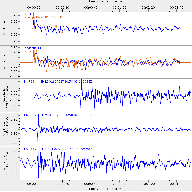
R33M Jennings River, BC, CAN - Earthquake Result Viewer
*The percent match for this event was below the threshold and hence no stack was calculated.
| Earthquake location: |
Northeast Of Taiwan |
| Earthquake latitude/longitude: |
25.3/124.4 |
| Earthquake time(UTC): |
2019/07/22 (203) 20:46:58 GMT |
| Earthquake Depth: |
100 km |
| Earthquake Magnitude: |
5.1 Mww |
| Earthquake Catalog/Contributor: |
NEIC PDE/us |
|
| Network: |
TA USArray Transportable Network (new EarthScope stations) |
| Station: |
R33M Jennings River, BC, CAN |
| Lat/Lon: |
59.39 N/130.97 W |
| Elevation: |
1437 m |
|
| Distance: |
75.7 deg |
| Az: |
30.72 deg |
| Baz: |
295.302 deg |
| Ray Param: |
$rayparam |
*The percent match for this event was below the threshold and hence was not used in the summary stack. |
|
| Radial Match: |
64.24317 % |
| Radial Bump: |
400 |
| Transverse Match: |
50.31198 % |
| Transverse Bump: |
400 |
| SOD ConfigId: |
19053131 |
| Insert Time: |
2019-08-05 20:54:17.714 +0000 |
| GWidth: |
2.5 |
| Max Bumps: |
400 |
| Tol: |
0.001 |
|
Signal To Noise
| Channel | StoN | STA | LTA |
| TA:R33M: :BHZ:20190722T20:58:02.199988Z | 6.1616764 | 3.2414525E-7 | 5.2606666E-8 |
| TA:R33M: :BHN:20190722T20:58:02.199988Z | 1.8297344 | 9.77528E-8 | 5.3424586E-8 |
| TA:R33M: :BHE:20190722T20:58:02.199988Z | 2.956596 | 1.0956622E-7 | 3.7058232E-8 |
| Arrivals |
| Ps | |
| PpPs | |
| PsPs/PpSs | |


