You are here: Home > Network List > TA - USArray Transportable Network (new EarthScope stations) Stations List
> Station U10A Ash Meadows, Armagosa NV, USA > Earthquake Result Viewer
U10A Ash Meadows, Armagosa NV, USA - Earthquake Result Viewer
| Earthquake location: |
Southeast Of Loyalty Islands |
| Earthquake latitude/longitude: |
-21.2/169.4 |
| Earthquake time(UTC): |
2007/09/28 (271) 01:01:48 GMT |
| Earthquake Depth: |
10 km |
| Earthquake Magnitude: |
5.8 MB, 6.4 MS, 6.3 MW, 6.2 MW |
| Earthquake Catalog/Contributor: |
WHDF/NEIC |
|
| Network: |
TA USArray Transportable Network (new EarthScope stations) |
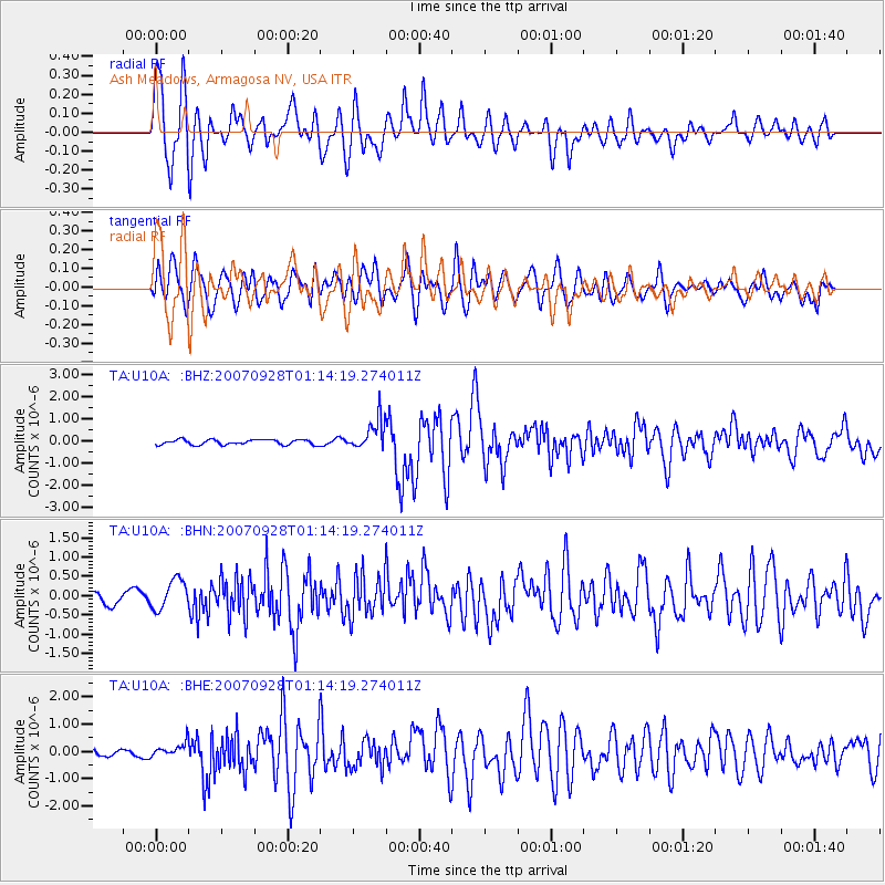
| Station: |
U10A Ash Meadows, Armagosa NV, USA |
| Lat/Lon: |
36.42 N/116.33 W |
| Elevation: |
668 m |
|
| Distance: |
90.5 deg |
| Az: |
50.947 deg |
| Baz: |
243.945 deg |
| Ray Param: |
0.041667774 |
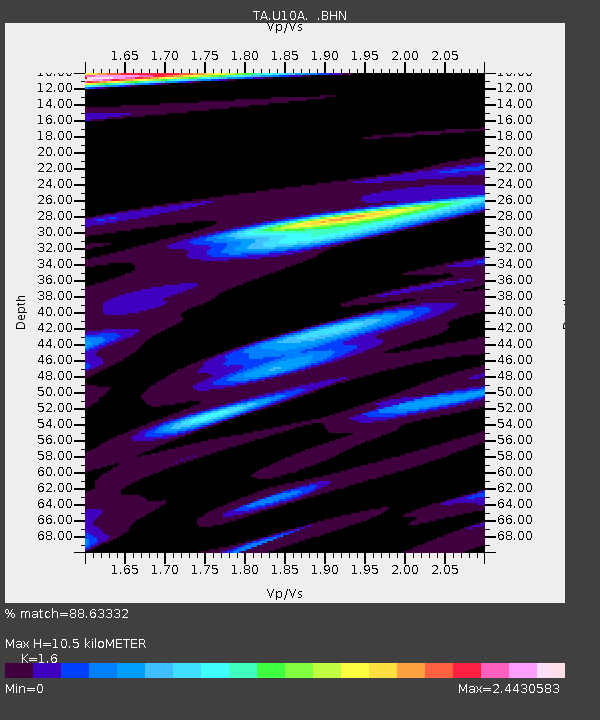
| Estimated Moho Depth: |
10.5 km |
| Estimated Crust Vp/Vs: |
1.60 |
| Assumed Crust Vp: |
6.279 km/s |
| Estimated Crust Vs: |
3.924 km/s |
| Estimated Crust Poisson's Ratio: |
0.18 |
|
| Radial Match: |
88.63332 % |
| Radial Bump: |
400 |
| Transverse Match: |
70.58682 % |
| Transverse Bump: |
400 |
| SOD ConfigId: |
2564 |
| Insert Time: |
2010-03-07 02:08:56.875 +0000 |
| GWidth: |
2.5 |
| Max Bumps: |
400 |
| Tol: |
0.001 |
|
Signal To Noise
| Channel | StoN | STA | LTA |
| TA:U10A: :BHN:20070928T01:14:19.274011Z | 1.7230864 | 3.8332473E-7 | 2.2246402E-7 |
| TA:U10A: :BHE:20070928T01:14:19.274011Z | 1.1602331 | 2.565173E-7 | 2.2109118E-7 |
| TA:U10A: :BHZ:20070928T01:14:19.274011Z | 5.939178 | 6.857965E-7 | 1.1546994E-7 |
| Arrivals |
| Ps | 1.0 SECOND |
| PpPs | 4.3 SECOND |
| PsPs/PpSs | 5.3 SECOND |


