You are here: Home > Network List > GS - US Geological Survey Networks Stations List
> Station DEC06 Boomer > Earthquake Result Viewer
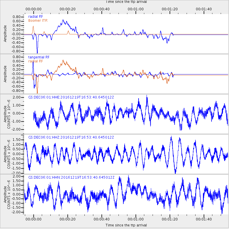
DEC06 Boomer - Earthquake Result Viewer
*The percent match for this event was below the threshold and hence no stack was calculated.
| Earthquake location: |
Near East Coast Of Honshu, Japan |
| Earthquake latitude/longitude: |
37.5/141.5 |
| Earthquake time(UTC): |
2016/12/19 (354) 16:41:14 GMT |
| Earthquake Depth: |
27 km |
| Earthquake Magnitude: |
5.5 mb |
| Earthquake Catalog/Contributor: |
NEIC PDE/us |
|
| Network: |
GS US Geological Survey Networks |
| Station: |
DEC06 Boomer |
| Lat/Lon: |
39.90 N/88.95 W |
| Elevation: |
215 m |
|
| Distance: |
90.2 deg |
| Az: |
36.377 deg |
| Baz: |
322.155 deg |
| Ray Param: |
$rayparam |
*The percent match for this event was below the threshold and hence was not used in the summary stack. |
|
| Radial Match: |
38.365078 % |
| Radial Bump: |
400 |
| Transverse Match: |
70.18721 % |
| Transverse Bump: |
400 |
| SOD ConfigId: |
1894071 |
| Insert Time: |
2017-01-02 16:43:39.402 +0000 |
| GWidth: |
2.5 |
| Max Bumps: |
400 |
| Tol: |
0.001 |
|
Signal To Noise
| Channel | StoN | STA | LTA |
| GS:DEC06:01:HHZ:20161219T16:53:40.645012Z | 1.5734811 | 6.3304765E-7 | 4.0232302E-7 |
| GS:DEC06:01:HHN:20161219T16:53:40.645012Z | 1.1670374 | 7.9336905E-7 | 6.7981466E-7 |
| GS:DEC06:01:HHE:20161219T16:53:40.645012Z | 0.76169115 | 5.7581326E-7 | 7.559668E-7 |
| Arrivals |
| Ps | |
| PpPs | |
| PsPs/PpSs | |


