You are here: Home > Network List > GS - US Geological Survey Networks Stations List
> Station KAN08 Pence Farm, Harper, KS, USA > Earthquake Result Viewer
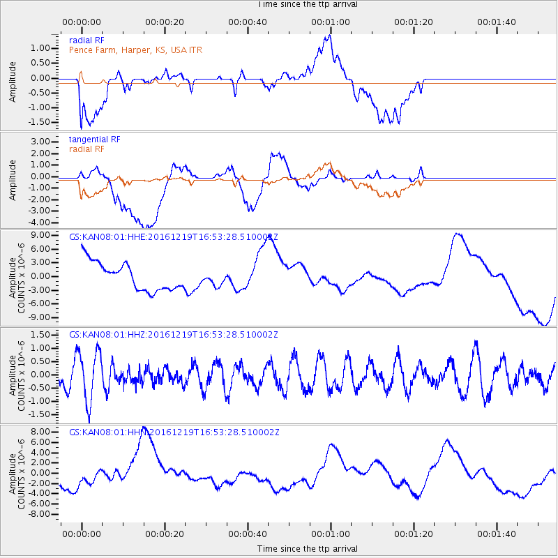
KAN08 Pence Farm, Harper, KS, USA - Earthquake Result Viewer
*The percent match for this event was below the threshold and hence no stack was calculated.
| Earthquake location: |
Near East Coast Of Honshu, Japan |
| Earthquake latitude/longitude: |
37.5/141.5 |
| Earthquake time(UTC): |
2016/12/19 (354) 16:41:14 GMT |
| Earthquake Depth: |
27 km |
| Earthquake Magnitude: |
5.5 mb |
| Earthquake Catalog/Contributor: |
NEIC PDE/us |
|
| Network: |
GS US Geological Survey Networks |
| Station: |
KAN08 Pence Farm, Harper, KS, USA |
| Lat/Lon: |
37.23 N/97.97 W |
| Elevation: |
375 m |
|
| Distance: |
87.6 deg |
| Az: |
43.48 deg |
| Baz: |
316.683 deg |
| Ray Param: |
$rayparam |
*The percent match for this event was below the threshold and hence was not used in the summary stack. |
|
| Radial Match: |
12.994981 % |
| Radial Bump: |
400 |
| Transverse Match: |
19.078562 % |
| Transverse Bump: |
400 |
| SOD ConfigId: |
1894071 |
| Insert Time: |
2017-01-02 16:43:45.360 +0000 |
| GWidth: |
2.5 |
| Max Bumps: |
400 |
| Tol: |
0.001 |
|
Signal To Noise
| Channel | StoN | STA | LTA |
| GS:KAN08:01:HHZ:20161219T16:53:28.510002Z | 2.2038808 | 9.609333E-7 | 4.3601875E-7 |
| GS:KAN08:01:HHN:20161219T16:53:28.510002Z | 0.8480936 | 1.0822653E-6 | 1.2761153E-6 |
| GS:KAN08:01:HHE:20161219T16:53:28.510002Z | 0.47316667 | 1.4440841E-6 | 3.0519564E-6 |
| Arrivals |
| Ps | |
| PpPs | |
| PsPs/PpSs | |


