You are here: Home > Network List > GS - US Geological Survey Networks Stations List
> Station OK031 2598 S. Brethren Rd., Cushing, OK, USA > Earthquake Result Viewer
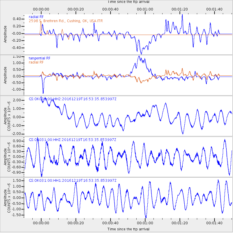
OK031 2598 S. Brethren Rd., Cushing, OK, USA - Earthquake Result Viewer
*The percent match for this event was below the threshold and hence no stack was calculated.
| Earthquake location: |
Near East Coast Of Honshu, Japan |
| Earthquake latitude/longitude: |
37.5/141.5 |
| Earthquake time(UTC): |
2016/12/19 (354) 16:41:14 GMT |
| Earthquake Depth: |
27 km |
| Earthquake Magnitude: |
5.5 mb |
| Earthquake Catalog/Contributor: |
NEIC PDE/us |
|
| Network: |
GS US Geological Survey Networks |
| Station: |
OK031 2598 S. Brethren Rd., Cushing, OK, USA |
| Lat/Lon: |
35.95 N/96.84 W |
| Elevation: |
290 m |
|
| Distance: |
89.1 deg |
| Az: |
43.68 deg |
| Baz: |
317.361 deg |
| Ray Param: |
$rayparam |
*The percent match for this event was below the threshold and hence was not used in the summary stack. |
|
| Radial Match: |
42.32213 % |
| Radial Bump: |
400 |
| Transverse Match: |
49.064762 % |
| Transverse Bump: |
400 |
| SOD ConfigId: |
1894071 |
| Insert Time: |
2017-01-02 16:43:56.794 +0000 |
| GWidth: |
2.5 |
| Max Bumps: |
400 |
| Tol: |
0.001 |
|
Signal To Noise
| Channel | StoN | STA | LTA |
| GS:OK031:00:HHZ:20161219T16:53:35.853997Z | 1.9992554 | 6.268079E-7 | 3.1352064E-7 |
| GS:OK031:00:HH1:20161219T16:53:35.853997Z | 0.82258993 | 6.406428E-7 | 7.7881185E-7 |
| GS:OK031:00:HH2:20161219T16:53:35.853997Z | 1.4167746 | 1.3278107E-6 | 9.3720666E-7 |
| Arrivals |
| Ps | |
| PpPs | |
| PsPs/PpSs | |


