You are here: Home > Network List > IU - Global Seismograph Network (GSN - IRIS/USGS) Stations List
> Station JOHN Johnston Island, USA > Earthquake Result Viewer
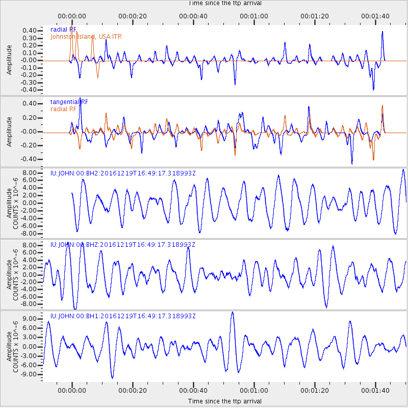
JOHN Johnston Island, USA - Earthquake Result Viewer
*The percent match for this event was below the threshold and hence no stack was calculated.
| Earthquake location: |
Near East Coast Of Honshu, Japan |
| Earthquake latitude/longitude: |
37.5/141.5 |
| Earthquake time(UTC): |
2016/12/19 (354) 16:41:14 GMT |
| Earthquake Depth: |
27 km |
| Earthquake Magnitude: |
5.5 mb |
| Earthquake Catalog/Contributor: |
NEIC PDE/us |
|
| Network: |
IU Global Seismograph Network (GSN - IRIS/USGS) |
| Station: |
JOHN Johnston Island, USA |
| Lat/Lon: |
16.73 N/169.53 W |
| Elevation: |
2.0 m |
|
| Distance: |
47.6 deg |
| Az: |
101.959 deg |
| Baz: |
305.659 deg |
| Ray Param: |
$rayparam |
*The percent match for this event was below the threshold and hence was not used in the summary stack. |
|
| Radial Match: |
67.40387 % |
| Radial Bump: |
363 |
| Transverse Match: |
74.893684 % |
| Transverse Bump: |
400 |
| SOD ConfigId: |
1894071 |
| Insert Time: |
2017-01-02 16:44:35.342 +0000 |
| GWidth: |
2.5 |
| Max Bumps: |
400 |
| Tol: |
0.001 |
|
Signal To Noise
| Channel | StoN | STA | LTA |
| IU:JOHN:00:BHZ:20161219T16:49:17.318993Z | 1.8823031 | 6.3951784E-6 | 3.3975284E-6 |
| IU:JOHN:00:BH1:20161219T16:49:17.318993Z | 0.36048782 | 1.8155368E-6 | 5.0363337E-6 |
| IU:JOHN:00:BH2:20161219T16:49:17.318993Z | 1.2212133 | 3.7639147E-6 | 3.0821109E-6 |
| Arrivals |
| Ps | |
| PpPs | |
| PsPs/PpSs | |


