You are here: Home > Network List > AV - Alaska Volcano Observatory Stations List
> Station SPCR Ckakachatna River, Mount Spurr, Alaska > Earthquake Result Viewer
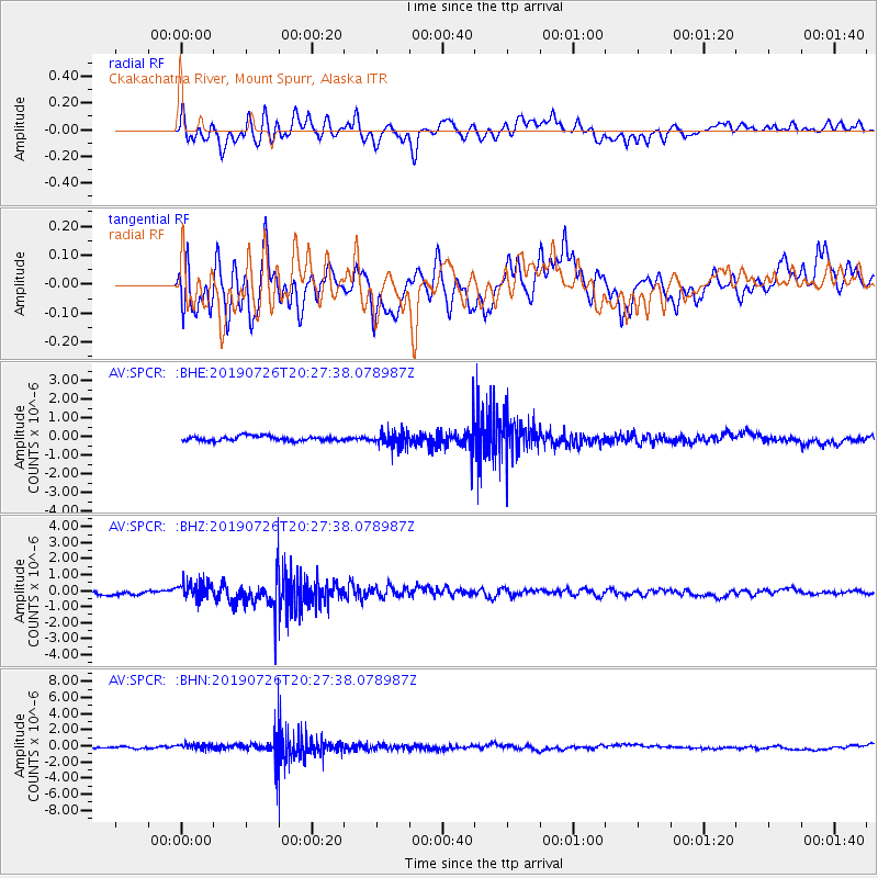
SPCR Ckakachatna River, Mount Spurr, Alaska - Earthquake Result Viewer
*The percent match for this event was below the threshold and hence no stack was calculated.
| Earthquake location: |
Philippine Islands Region |
| Earthquake latitude/longitude: |
20.8/121.9 |
| Earthquake time(UTC): |
2019/07/26 (207) 20:16:57 GMT |
| Earthquake Depth: |
9.1 km |
| Earthquake Magnitude: |
5.4 Mww |
| Earthquake Catalog/Contributor: |
NEIC PDE/us |
|
| Network: |
AV Alaska Volcano Observatory |
| Station: |
SPCR Ckakachatna River, Mount Spurr, Alaska |
| Lat/Lon: |
61.20 N/152.21 W |
| Elevation: |
984 m |
|
| Distance: |
70.1 deg |
| Az: |
30.92 deg |
| Baz: |
276.89 deg |
| Ray Param: |
$rayparam |
*The percent match for this event was below the threshold and hence was not used in the summary stack. |
|
| Radial Match: |
71.21216 % |
| Radial Bump: |
400 |
| Transverse Match: |
66.8712 % |
| Transverse Bump: |
400 |
| SOD ConfigId: |
19053131 |
| Insert Time: |
2019-08-09 20:18:53.454 +0000 |
| GWidth: |
2.5 |
| Max Bumps: |
400 |
| Tol: |
0.001 |
|
Signal To Noise
| Channel | StoN | STA | LTA |
| AV:SPCR: :BHZ:20190726T20:27:38.078987Z | 3.385191 | 5.2403175E-7 | 1.5480124E-7 |
| AV:SPCR: :BHN:20190726T20:27:38.078987Z | 2.6392028 | 3.4762041E-7 | 1.3171417E-7 |
| AV:SPCR: :BHE:20190726T20:27:38.078987Z | 3.0681183 | 4.001584E-7 | 1.304247E-7 |
| Arrivals |
| Ps | |
| PpPs | |
| PsPs/PpSs | |


