You are here: Home > Network List > US - United States National Seismic Network Stations List
> Station AMTX Amarillo, Texas, USA > Earthquake Result Viewer
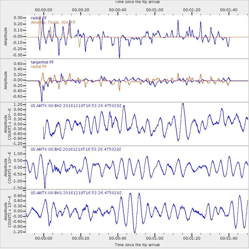
AMTX Amarillo, Texas, USA - Earthquake Result Viewer
*The percent match for this event was below the threshold and hence no stack was calculated.
| Earthquake location: |
Near East Coast Of Honshu, Japan |
| Earthquake latitude/longitude: |
37.5/141.5 |
| Earthquake time(UTC): |
2016/12/19 (354) 16:41:14 GMT |
| Earthquake Depth: |
27 km |
| Earthquake Magnitude: |
5.5 mb |
| Earthquake Catalog/Contributor: |
NEIC PDE/us |
|
| Network: |
US United States National Seismic Network |
| Station: |
AMTX Amarillo, Texas, USA |
| Lat/Lon: |
34.53 N/101.41 W |
| Elevation: |
1010 m |
|
| Distance: |
87.6 deg |
| Az: |
47.36 deg |
| Baz: |
314.84 deg |
| Ray Param: |
$rayparam |
*The percent match for this event was below the threshold and hence was not used in the summary stack. |
|
| Radial Match: |
43.341564 % |
| Radial Bump: |
347 |
| Transverse Match: |
50.07895 % |
| Transverse Bump: |
400 |
| SOD ConfigId: |
1894071 |
| Insert Time: |
2017-01-02 16:45:47.408 +0000 |
| GWidth: |
2.5 |
| Max Bumps: |
400 |
| Tol: |
0.001 |
|
Signal To Noise
| Channel | StoN | STA | LTA |
| US:AMTX:00:BHZ:20161219T16:53:26.475029Z | 1.7078326 | 6.0254035E-7 | 3.5281E-7 |
| US:AMTX:00:BH1:20161219T16:53:26.475029Z | 1.9478433 | 4.798588E-7 | 2.463539E-7 |
| US:AMTX:00:BH2:20161219T16:53:26.475029Z | 1.7106229 | 5.852036E-7 | 3.4209972E-7 |
| Arrivals |
| Ps | |
| PpPs | |
| PsPs/PpSs | |


