You are here: Home > Network List > TA - USArray Transportable Network (new EarthScope stations) Stations List
> Station F06A Goldendale, WA, USA > Earthquake Result Viewer
F06A Goldendale, WA, USA - Earthquake Result Viewer

| Earthquake location: |
South Of Fiji Islands |
| Earthquake latitude/longitude: |
-26.0/-177.5 |
| Earthquake time(UTC): |
2007/12/09 (343) 07:28:20 GMT |
| Earthquake Depth: |
152 km |
| Earthquake Magnitude: |
7.0 MB, 7.8 MW, 7.7 MW |
| Earthquake Catalog/Contributor: |
WHDF/NEIC |
|
| Network: |
TA USArray Transportable Network (new EarthScope stations) |
| Station: |
F06A Goldendale, WA, USA |
| Lat/Lon: |
45.77 N/120.78 W |
| Elevation: |
577 m |
|
| Distance: |
88.0 deg |
| Az: |
35.846 deg |
| Baz: |
228.845 deg |
| Ray Param: |
0.0425423 |
| Estimated Moho Depth: |
33.75 km |
| Estimated Crust Vp/Vs: |
1.86 |
| Assumed Crust Vp: |
6.597 km/s |
| Estimated Crust Vs: |
3.557 km/s |
| Estimated Crust Poisson's Ratio: |
0.30 |
|
| Radial Match: |
97.432884 % |
| Radial Bump: |
388 |
| Transverse Match: |
90.4172 % |
| Transverse Bump: |
400 |
| SOD ConfigId: |
2564 |
| Insert Time: |
2010-03-07 02:10:03.494 +0000 |
| GWidth: |
2.5 |
| Max Bumps: |
400 |
| Tol: |
0.001 |
|
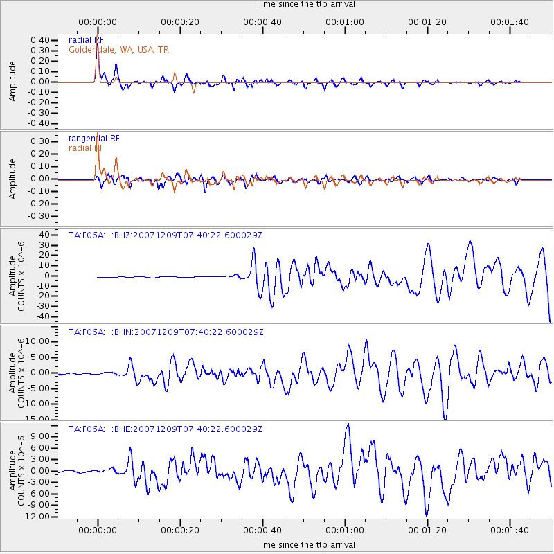
Signal To Noise
| Channel | StoN | STA | LTA |
| TA:F06A: :BHN:20071209T07:40:22.600029Z | 2.4319599 | 3.5329586E-7 | 1.4527208E-7 |
| TA:F06A: :BHE:20071209T07:40:22.600029Z | 1.9328873 | 4.780258E-7 | 2.4731176E-7 |
| TA:F06A: :BHZ:20071209T07:40:22.600029Z | 3.6949992 | 1.1722703E-6 | 3.172586E-7 |
| Arrivals |
| Ps | 4.5 SECOND |
| PpPs | 14 SECOND |
| PsPs/PpSs | 19 SECOND |


