You are here: Home > Network List > TA - USArray Transportable Network (new EarthScope stations) Stations List
> Station F06A Goldendale, WA, USA > Earthquake Result Viewer
F06A Goldendale, WA, USA - Earthquake Result Viewer

| Earthquake location: |
Near West Coast Of Colombia |
| Earthquake latitude/longitude: |
3.0/-78.0 |
| Earthquake time(UTC): |
2007/09/10 (253) 01:49:14 GMT |
| Earthquake Depth: |
31 km |
| Earthquake Magnitude: |
6.1 MB, 6.7 MS, 6.8 MW |
| Earthquake Catalog/Contributor: |
WHDF/NEIC |
|
| Network: |
TA USArray Transportable Network (new EarthScope stations) |
| Station: |
F06A Goldendale, WA, USA |
| Lat/Lon: |
45.77 N/120.78 W |
| Elevation: |
577 m |
|
| Distance: |
56.7 deg |
| Az: |
325.285 deg |
| Baz: |
125.66 deg |
| Ray Param: |
0.06394725 |
| Estimated Moho Depth: |
17.5 km |
| Estimated Crust Vp/Vs: |
1.61 |
| Assumed Crust Vp: |
6.597 km/s |
| Estimated Crust Vs: |
4.104 km/s |
| Estimated Crust Poisson's Ratio: |
0.18 |
|
| Radial Match: |
97.134575 % |
| Radial Bump: |
311 |
| Transverse Match: |
88.64055 % |
| Transverse Bump: |
400 |
| SOD ConfigId: |
2564 |
| Insert Time: |
2010-03-07 02:10:13.424 +0000 |
| GWidth: |
2.5 |
| Max Bumps: |
400 |
| Tol: |
0.001 |
|
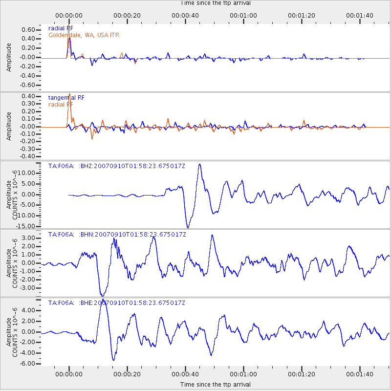
Signal To Noise
| Channel | StoN | STA | LTA |
| TA:F06A: :BHN:20070910T01:58:23.675017Z | 5.305254 | 4.9778953E-7 | 9.3829534E-8 |
| TA:F06A: :BHE:20070910T01:58:23.675017Z | 3.656442 | 5.1705246E-7 | 1.4140863E-7 |
| TA:F06A: :BHZ:20070910T01:58:23.675017Z | 6.4788 | 1.6283101E-6 | 2.5132897E-7 |
| Arrivals |
| Ps | 1.7 SECOND |
| PpPs | 6.5 SECOND |
| PsPs/PpSs | 8.2 SECOND |


