F06A Goldendale, WA, USA - Earthquake Result Viewer
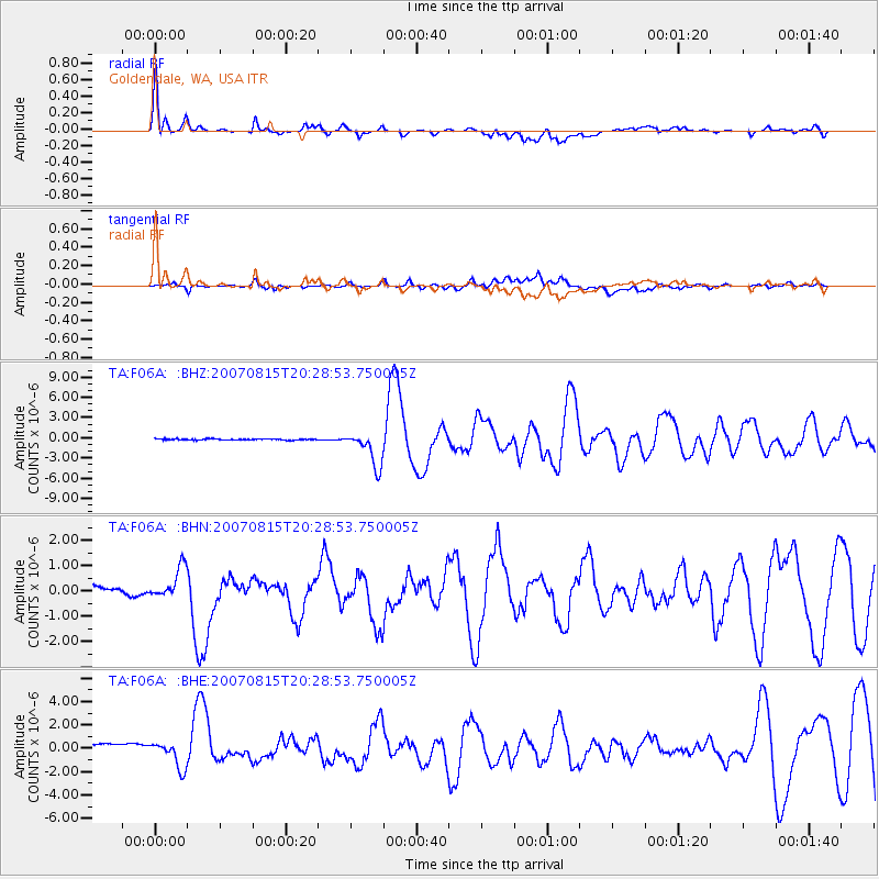
Earthquake location: Andreanof Islands, Aleutian Is.
Earthquake latitude/longitude: 50.3/-177.5
Earthquake time(UTC): 2007/08/15 (227) 20:22:11 GMT
Earthquake Depth: 9.0 km
Earthquake Magnitude: 6.3 MB, 6.2 MS, 6.4 MW, 5.9 ML
Earthquake Catalog/Contributor: WHDF/NEIC
Network: TA USArray Transportable Network (new EarthScope stations)
Station: F06A Goldendale, WA, USA
Lat/Lon: 45.77 N/120.78 W
Elevation: 577 m
Distance: 37.4 deg
Az: 74.413 deg
Baz: 298.107 deg
Ray Param: 0.076140225
Estimated Moho Depth: 40.75 km
Estimated Crust Vp/Vs: 1.69
Assumed Crust Vp: 6.597 km/s
Estimated Crust Vs: 3.904 km/s
Estimated Crust Poisson's Ratio: 0.23
Radial Match: 90.01799 %
Radial Bump: 400
Transverse Match: 77.202835 %
Transverse Bump: 400
SOD ConfigId: 2564
Insert Time: 2010-03-07 02:10:29.090 +0000
GWidth: 2.5
Max Bumps: 400
Tol: 0.001

Signal To Noise

ChannelStoNSTALTA
TA:F06A: :BHN:20070815T20:28:53.750005Z1.2775925.918985E-74.632923E-7
TA:F06A: :BHE:20070815T20:28:53.750005Z1.12247031.0396212E-69.2619047E-7
TA:F06A: :BHZ:20070815T20:28:53.750005Z29.9056422.5809438E-68.630291E-8
Arrivals
Ps4.6 SECOND
PpPs15 SECOND
PsPs/PpSs20 SECOND