F06A Goldendale, WA, USA - Earthquake Result Viewer
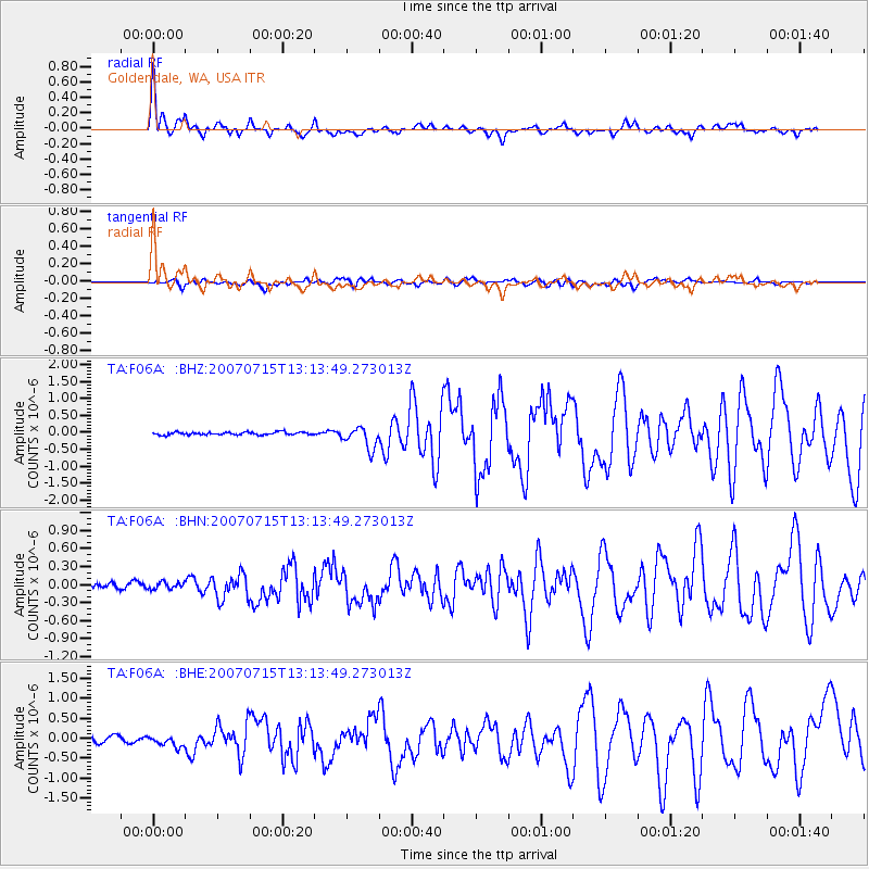
Earthquake location: Fox Islands, Aleutian Islands
Earthquake latitude/longitude: 52.5/-168.0
Earthquake time(UTC): 2007/07/15 (196) 13:08:00 GMT
Earthquake Depth: 10 km
Earthquake Magnitude: 5.8 MB, 5.9 MS, 6.1 MW, 6.0 MW
Earthquake Catalog/Contributor: WHDF/NEIC
Network: TA USArray Transportable Network (new EarthScope stations)
Station: F06A Goldendale, WA, USA
Lat/Lon: 45.77 N/120.78 W
Elevation: 577 m
Distance: 31.2 deg
Az: 83.235 deg
Baz: 299.81 deg
Ray Param: 0.0791368
Estimated Moho Depth: 17.5 km
Estimated Crust Vp/Vs: 1.60
Assumed Crust Vp: 6.597 km/s
Estimated Crust Vs: 4.123 km/s
Estimated Crust Poisson's Ratio: 0.18
Radial Match: 90.04884 %
Radial Bump: 400
Transverse Match: 77.84566 %
Transverse Bump: 400
SOD ConfigId: 2564
Insert Time: 2010-03-07 02:10:42.162 +0000
GWidth: 2.5
Max Bumps: 400
Tol: 0.001

Signal To Noise

ChannelStoNSTALTA
TA:F06A: :BHN:20070715T13:13:49.273013Z1.43389235.8636832E-84.089347E-8
TA:F06A: :BHE:20070715T13:13:49.273013Z1.93684381.3367735E-76.9018135E-8
TA:F06A: :BHZ:20070715T13:13:49.273013Z7.7051563.1590685E-74.099941E-8
Arrivals
Ps1.7 SECOND
PpPs6.3 SECOND
PsPs/PpSs8.0 SECOND