You are here: Home > Network List > TA - USArray Transportable Network (new EarthScope stations) Stations List
> Station I23K Minto, Yukon-Koyukuk, AK, USA > Earthquake Result Viewer
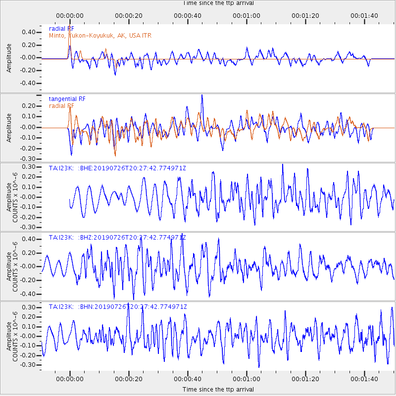
I23K Minto, Yukon-Koyukuk, AK, USA - Earthquake Result Viewer
*The percent match for this event was below the threshold and hence no stack was calculated.
| Earthquake location: |
Philippine Islands Region |
| Earthquake latitude/longitude: |
20.8/121.9 |
| Earthquake time(UTC): |
2019/07/26 (207) 20:16:57 GMT |
| Earthquake Depth: |
9.1 km |
| Earthquake Magnitude: |
5.4 Mww |
| Earthquake Catalog/Contributor: |
NEIC PDE/us |
|
| Network: |
TA USArray Transportable Network (new EarthScope stations) |
| Station: |
I23K Minto, Yukon-Koyukuk, AK, USA |
| Lat/Lon: |
65.15 N/149.36 W |
| Elevation: |
149 m |
|
| Distance: |
70.8 deg |
| Az: |
26.573 deg |
| Baz: |
277.974 deg |
| Ray Param: |
$rayparam |
*The percent match for this event was below the threshold and hence was not used in the summary stack. |
|
| Radial Match: |
54.030914 % |
| Radial Bump: |
400 |
| Transverse Match: |
70.56939 % |
| Transverse Bump: |
400 |
| SOD ConfigId: |
19053131 |
| Insert Time: |
2019-08-09 20:22:16.307 +0000 |
| GWidth: |
2.5 |
| Max Bumps: |
400 |
| Tol: |
0.001 |
|
Signal To Noise
| Channel | StoN | STA | LTA |
| TA:I23K: :BHZ:20190726T20:27:42.774971Z | 1.817093 | 1.4788382E-7 | 8.138484E-8 |
| TA:I23K: :BHN:20190726T20:27:42.774971Z | 1.1960536 | 8.655063E-8 | 7.23635E-8 |
| TA:I23K: :BHE:20190726T20:27:42.774971Z | 1.37782 | 1.15538064E-7 | 8.38557E-8 |
| Arrivals |
| Ps | |
| PpPs | |
| PsPs/PpSs | |


