You are here: Home > Network List > TA - USArray Transportable Network (new EarthScope stations) Stations List
> Station G31M Satah River, YT, CAN > Earthquake Result Viewer
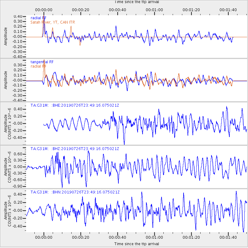
G31M Satah River, YT, CAN - Earthquake Result Viewer
*The percent match for this event was below the threshold and hence no stack was calculated.
| Earthquake location: |
Philippine Islands Region |
| Earthquake latitude/longitude: |
20.8/122.0 |
| Earthquake time(UTC): |
2019/07/26 (207) 23:37:58 GMT |
| Earthquake Depth: |
10 km |
| Earthquake Magnitude: |
5.9 Mww |
| Earthquake Catalog/Contributor: |
NEIC PDE/us |
|
| Network: |
TA USArray Transportable Network (new EarthScope stations) |
| Station: |
G31M Satah River, YT, CAN |
| Lat/Lon: |
66.92 N/134.27 W |
| Elevation: |
61 m |
|
| Distance: |
76.3 deg |
| Az: |
23.212 deg |
| Baz: |
290.71 deg |
| Ray Param: |
$rayparam |
*The percent match for this event was below the threshold and hence was not used in the summary stack. |
|
| Radial Match: |
74.103806 % |
| Radial Bump: |
400 |
| Transverse Match: |
69.27442 % |
| Transverse Bump: |
400 |
| SOD ConfigId: |
19053131 |
| Insert Time: |
2019-08-09 23:43:04.030 +0000 |
| GWidth: |
2.5 |
| Max Bumps: |
400 |
| Tol: |
0.001 |
|
Signal To Noise
| Channel | StoN | STA | LTA |
| TA:G31M: :BHZ:20190726T23:49:16.075021Z | 4.1953583 | 2.3345282E-7 | 5.56455E-8 |
| TA:G31M: :BHN:20190726T23:49:16.075021Z | 1.7893893 | 1.16515E-7 | 6.511439E-8 |
| TA:G31M: :BHE:20190726T23:49:16.075021Z | 0.54517496 | 5.8504725E-8 | 1.0731367E-7 |
| Arrivals |
| Ps | |
| PpPs | |
| PsPs/PpSs | |


