You are here: Home > Network List > US - United States National Seismic Network Stations List
> Station EGMT Eagleton, Montana, USA > Earthquake Result Viewer
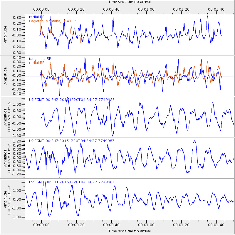
EGMT Eagleton, Montana, USA - Earthquake Result Viewer
*The percent match for this event was below the threshold and hence no stack was calculated.
| Earthquake location: |
Solomon Islands |
| Earthquake latitude/longitude: |
-10.2/161.2 |
| Earthquake time(UTC): |
2016/12/20 (355) 04:21:28 GMT |
| Earthquake Depth: |
11 km |
| Earthquake Magnitude: |
6.4 mww |
| Earthquake Catalog/Contributor: |
NEIC PDE/us |
|
| Network: |
US United States National Seismic Network |
| Station: |
EGMT Eagleton, Montana, USA |
| Lat/Lon: |
48.02 N/109.75 W |
| Elevation: |
1055 m |
|
| Distance: |
96.9 deg |
| Az: |
42.536 deg |
| Baz: |
262.43 deg |
| Ray Param: |
$rayparam |
*The percent match for this event was below the threshold and hence was not used in the summary stack. |
|
| Radial Match: |
77.486755 % |
| Radial Bump: |
400 |
| Transverse Match: |
47.908524 % |
| Transverse Bump: |
400 |
| SOD ConfigId: |
1894071 |
| Insert Time: |
2017-01-03 04:23:36.728 +0000 |
| GWidth: |
2.5 |
| Max Bumps: |
400 |
| Tol: |
0.001 |
|
Signal To Noise
| Channel | StoN | STA | LTA |
| US:EGMT:00:BHZ:20161220T04:34:27.774998Z | 1.061756 | 4.5517044E-7 | 4.286959E-7 |
| US:EGMT:00:BH1:20161220T04:34:27.774998Z | 2.7888334 | 1.5441362E-6 | 5.5368537E-7 |
| US:EGMT:00:BH2:20161220T04:34:27.774998Z | 0.7564534 | 5.5635985E-7 | 7.354846E-7 |
| Arrivals |
| Ps | |
| PpPs | |
| PsPs/PpSs | |


