You are here: Home > Network List > UU - University of Utah Regional Network Stations List
> Station FORU South Mineral Mountains, UT, USA > Earthquake Result Viewer
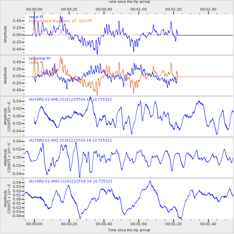
FORU South Mineral Mountains, UT, USA - Earthquake Result Viewer
*The percent match for this event was below the threshold and hence no stack was calculated.
| Earthquake location: |
Solomon Islands |
| Earthquake latitude/longitude: |
-10.2/161.2 |
| Earthquake time(UTC): |
2016/12/20 (355) 04:21:28 GMT |
| Earthquake Depth: |
11 km |
| Earthquake Magnitude: |
6.4 mww |
| Earthquake Catalog/Contributor: |
NEIC PDE/us |
|
| Network: |
UU University of Utah Regional Network |
| Station: |
FORU South Mineral Mountains, UT, USA |
| Lat/Lon: |
38.46 N/112.86 W |
| Elevation: |
1840 m |
|
| Distance: |
93.1 deg |
| Az: |
51.651 deg |
| Baz: |
259.507 deg |
| Ray Param: |
$rayparam |
*The percent match for this event was below the threshold and hence was not used in the summary stack. |
|
| Radial Match: |
72.13679 % |
| Radial Bump: |
400 |
| Transverse Match: |
75.053246 % |
| Transverse Bump: |
400 |
| SOD ConfigId: |
1894071 |
| Insert Time: |
2017-01-03 04:23:57.295 +0000 |
| GWidth: |
2.5 |
| Max Bumps: |
400 |
| Tol: |
0.001 |
|
Signal To Noise
| Channel | StoN | STA | LTA |
| UU:FORU:01:HHZ:20161220T04:34:10.73502Z | 1.8492305 | 1.3479337E-8 | 7.28916E-9 |
| UU:FORU:01:HHN:20161220T04:34:10.73502Z | 0.55672735 | 6.0488463E-9 | 1.0865006E-8 |
| UU:FORU:01:HHE:20161220T04:34:10.73502Z | 2.4958353 | 3.379778E-8 | 1.354167E-8 |
| Arrivals |
| Ps | |
| PpPs | |
| PsPs/PpSs | |


