You are here: Home > Network List > CI - Caltech Regional Seismic Network Stations List
> Station MUR Murrieta > Earthquake Result Viewer
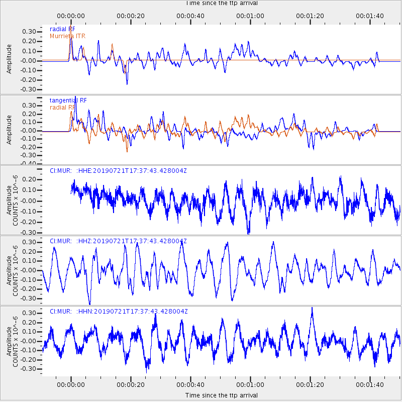
MUR Murrieta - Earthquake Result Viewer
*The percent match for this event was below the threshold and hence no stack was calculated.
| Earthquake location: |
South Of Mariana Islands |
| Earthquake latitude/longitude: |
12.3/144.4 |
| Earthquake time(UTC): |
2019/07/21 (202) 17:25:14 GMT |
| Earthquake Depth: |
10 km |
| Earthquake Magnitude: |
5.5 Mww |
| Earthquake Catalog/Contributor: |
NEIC PDE/us |
|
| Network: |
CI Caltech Regional Seismic Network |
| Station: |
MUR Murrieta |
| Lat/Lon: |
33.60 N/117.20 W |
| Elevation: |
562 m |
|
| Distance: |
90.1 deg |
| Az: |
55.657 deg |
| Baz: |
284.828 deg |
| Ray Param: |
$rayparam |
*The percent match for this event was below the threshold and hence was not used in the summary stack. |
|
| Radial Match: |
56.024113 % |
| Radial Bump: |
400 |
| Transverse Match: |
58.981216 % |
| Transverse Bump: |
400 |
| SOD ConfigId: |
19053131 |
| Insert Time: |
2019-08-10 18:03:28.207 +0000 |
| GWidth: |
2.5 |
| Max Bumps: |
400 |
| Tol: |
0.001 |
|
Signal To Noise
| Channel | StoN | STA | LTA |
| CI:MUR: :HHZ:20190721T17:37:43.428004Z | 0.932999 | 8.477431E-8 | 9.086216E-8 |
| CI:MUR: :HHN:20190721T17:37:43.428004Z | 1.1637136 | 9.767846E-8 | 8.3936854E-8 |
| CI:MUR: :HHE:20190721T17:37:43.428004Z | 1.4697293 | 8.61596E-8 | 5.862277E-8 |
| Arrivals |
| Ps | |
| PpPs | |
| PsPs/PpSs | |


