You are here: Home > Network List > TA - USArray Transportable Network (new EarthScope stations) Stations List
> Station F20K Avaraart Lake, AK, USA > Earthquake Result Viewer
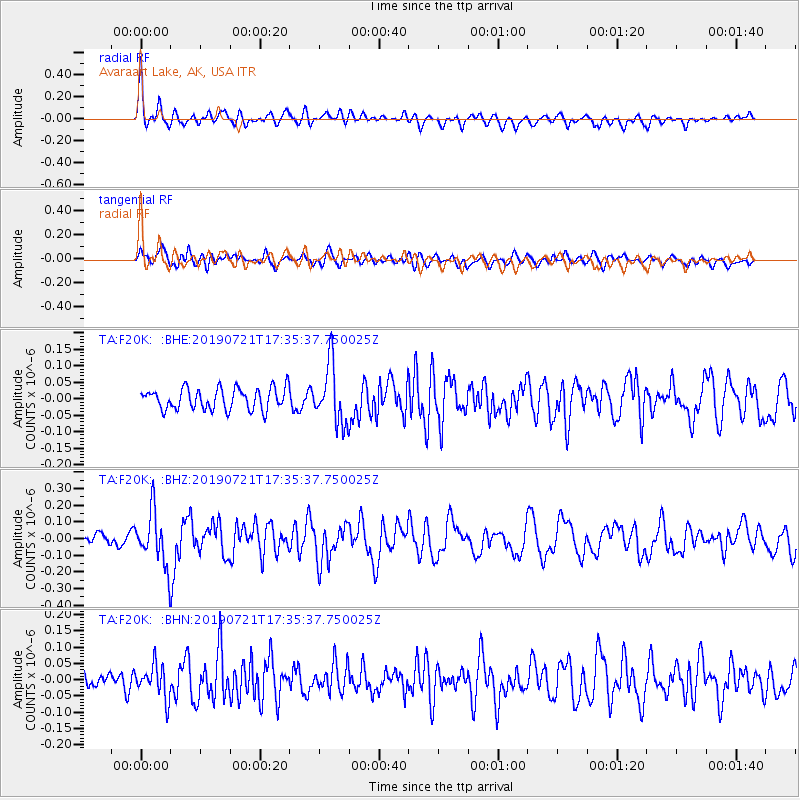
F20K Avaraart Lake, AK, USA - Earthquake Result Viewer
*The percent match for this event was below the threshold and hence no stack was calculated.
| Earthquake location: |
South Of Mariana Islands |
| Earthquake latitude/longitude: |
12.3/144.4 |
| Earthquake time(UTC): |
2019/07/21 (202) 17:25:14 GMT |
| Earthquake Depth: |
10 km |
| Earthquake Magnitude: |
5.5 Mww |
| Earthquake Catalog/Contributor: |
NEIC PDE/us |
|
| Network: |
TA USArray Transportable Network (new EarthScope stations) |
| Station: |
F20K Avaraart Lake, AK, USA |
| Lat/Lon: |
67.05 N/155.73 W |
| Elevation: |
136 m |
|
| Distance: |
67.2 deg |
| Az: |
21.591 deg |
| Baz: |
246.478 deg |
| Ray Param: |
$rayparam |
*The percent match for this event was below the threshold and hence was not used in the summary stack. |
|
| Radial Match: |
66.86637 % |
| Radial Bump: |
400 |
| Transverse Match: |
56.537018 % |
| Transverse Bump: |
400 |
| SOD ConfigId: |
19053131 |
| Insert Time: |
2019-08-10 18:06:40.117 +0000 |
| GWidth: |
2.5 |
| Max Bumps: |
400 |
| Tol: |
0.001 |
|
Signal To Noise
| Channel | StoN | STA | LTA |
| TA:F20K: :BHZ:20190721T17:35:37.750025Z | 3.7347646 | 1.5849926E-7 | 4.2438888E-8 |
| TA:F20K: :BHN:20190721T17:35:37.750025Z | 1.5960963 | 5.0980567E-8 | 3.1940782E-8 |
| TA:F20K: :BHE:20190721T17:35:37.750025Z | 2.7522697 | 8.90049E-8 | 3.233873E-8 |
| Arrivals |
| Ps | |
| PpPs | |
| PsPs/PpSs | |


