You are here: Home > Network List > TA - USArray Transportable Network (new EarthScope stations) Stations List
> Station G21K Allakaket, AK, USA > Earthquake Result Viewer
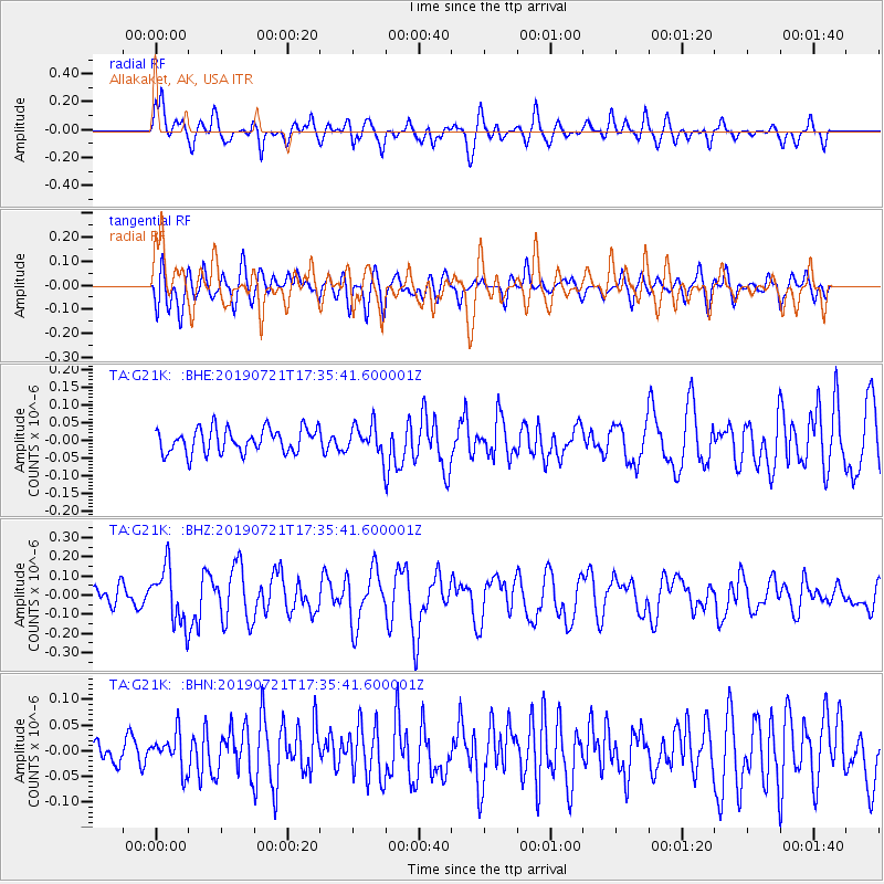
G21K Allakaket, AK, USA - Earthquake Result Viewer
*The percent match for this event was below the threshold and hence no stack was calculated.
| Earthquake location: |
South Of Mariana Islands |
| Earthquake latitude/longitude: |
12.3/144.4 |
| Earthquake time(UTC): |
2019/07/21 (202) 17:25:14 GMT |
| Earthquake Depth: |
10 km |
| Earthquake Magnitude: |
5.5 Mww |
| Earthquake Catalog/Contributor: |
NEIC PDE/us |
|
| Network: |
TA USArray Transportable Network (new EarthScope stations) |
| Station: |
G21K Allakaket, AK, USA |
| Lat/Lon: |
66.52 N/153.51 W |
| Elevation: |
446 m |
|
| Distance: |
67.8 deg |
| Az: |
22.489 deg |
| Baz: |
248.859 deg |
| Ray Param: |
$rayparam |
*The percent match for this event was below the threshold and hence was not used in the summary stack. |
|
| Radial Match: |
74.4066 % |
| Radial Bump: |
400 |
| Transverse Match: |
59.68665 % |
| Transverse Bump: |
400 |
| SOD ConfigId: |
19053131 |
| Insert Time: |
2019-08-10 18:06:46.460 +0000 |
| GWidth: |
2.5 |
| Max Bumps: |
400 |
| Tol: |
0.001 |
|
Signal To Noise
| Channel | StoN | STA | LTA |
| TA:G21K: :BHZ:20190721T17:35:41.600001Z | 2.8414354 | 1.443252E-7 | 5.0793062E-8 |
| TA:G21K: :BHN:20190721T17:35:41.600001Z | 1.2193996 | 3.5787217E-8 | 2.9348229E-8 |
| TA:G21K: :BHE:20190721T17:35:41.600001Z | 1.2171667 | 4.1748894E-8 | 3.4300065E-8 |
| Arrivals |
| Ps | |
| PpPs | |
| PsPs/PpSs | |


