You are here: Home > Network List > TA - USArray Transportable Network (new EarthScope stations) Stations List
> Station G23K Bananza Creek, AK, USA > Earthquake Result Viewer
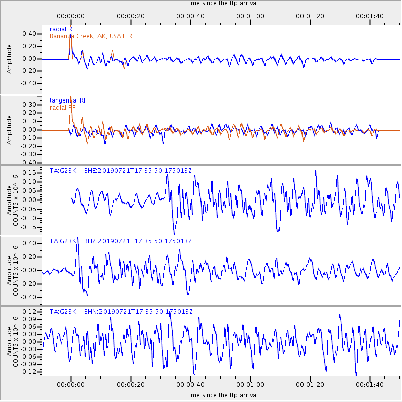
G23K Bananza Creek, AK, USA - Earthquake Result Viewer
*The percent match for this event was below the threshold and hence no stack was calculated.
| Earthquake location: |
South Of Mariana Islands |
| Earthquake latitude/longitude: |
12.3/144.4 |
| Earthquake time(UTC): |
2019/07/21 (202) 17:25:14 GMT |
| Earthquake Depth: |
10 km |
| Earthquake Magnitude: |
5.5 Mww |
| Earthquake Catalog/Contributor: |
NEIC PDE/us |
|
| Network: |
TA USArray Transportable Network (new EarthScope stations) |
| Station: |
G23K Bananza Creek, AK, USA |
| Lat/Lon: |
66.71 N/150.02 W |
| Elevation: |
746 m |
|
| Distance: |
69.2 deg |
| Az: |
22.789 deg |
| Baz: |
252.162 deg |
| Ray Param: |
$rayparam |
*The percent match for this event was below the threshold and hence was not used in the summary stack. |
|
| Radial Match: |
73.12871 % |
| Radial Bump: |
394 |
| Transverse Match: |
67.625336 % |
| Transverse Bump: |
400 |
| SOD ConfigId: |
19053131 |
| Insert Time: |
2019-08-10 18:06:47.079 +0000 |
| GWidth: |
2.5 |
| Max Bumps: |
400 |
| Tol: |
0.001 |
|
Signal To Noise
| Channel | StoN | STA | LTA |
| TA:G23K: :BHZ:20190721T17:35:50.175013Z | 4.6259546 | 2.111695E-7 | 4.564885E-8 |
| TA:G23K: :BHN:20190721T17:35:50.175013Z | 1.1968379 | 4.115449E-8 | 3.438602E-8 |
| TA:G23K: :BHE:20190721T17:35:50.175013Z | 2.4692068 | 7.922136E-8 | 3.2083726E-8 |
| Arrivals |
| Ps | |
| PpPs | |
| PsPs/PpSs | |


