You are here: Home > Network List > TA - USArray Transportable Network (new EarthScope stations) Stations List
> Station J26L Joseph Creek, AK, USA > Earthquake Result Viewer
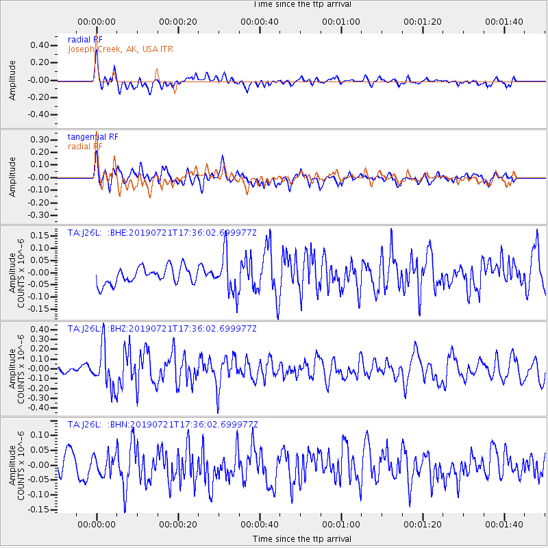
J26L Joseph Creek, AK, USA - Earthquake Result Viewer
*The percent match for this event was below the threshold and hence no stack was calculated.
| Earthquake location: |
South Of Mariana Islands |
| Earthquake latitude/longitude: |
12.3/144.4 |
| Earthquake time(UTC): |
2019/07/21 (202) 17:25:14 GMT |
| Earthquake Depth: |
10 km |
| Earthquake Magnitude: |
5.5 Mww |
| Earthquake Catalog/Contributor: |
NEIC PDE/us |
|
| Network: |
TA USArray Transportable Network (new EarthScope stations) |
| Station: |
J26L Joseph Creek, AK, USA |
| Lat/Lon: |
64.50 N/143.56 W |
| Elevation: |
1144 m |
|
| Distance: |
71.2 deg |
| Az: |
25.779 deg |
| Baz: |
259.054 deg |
| Ray Param: |
$rayparam |
*The percent match for this event was below the threshold and hence was not used in the summary stack. |
|
| Radial Match: |
66.284935 % |
| Radial Bump: |
400 |
| Transverse Match: |
65.21662 % |
| Transverse Bump: |
400 |
| SOD ConfigId: |
19053131 |
| Insert Time: |
2019-08-10 18:07:02.472 +0000 |
| GWidth: |
2.5 |
| Max Bumps: |
400 |
| Tol: |
0.001 |
|
Signal To Noise
| Channel | StoN | STA | LTA |
| TA:J26L: :BHZ:20190721T17:36:02.699977Z | 3.6676598 | 2.1223967E-7 | 5.7867872E-8 |
| TA:J26L: :BHN:20190721T17:36:02.699977Z | 1.0211741 | 3.2926515E-8 | 3.2243786E-8 |
| TA:J26L: :BHE:20190721T17:36:02.699977Z | 2.4714572 | 8.3299724E-8 | 3.3704698E-8 |
| Arrivals |
| Ps | |
| PpPs | |
| PsPs/PpSs | |


