You are here: Home > Network List > II - Global Seismograph Network (GSN - IRIS/IDA) Stations List
> Station WRAB Tennant Creek, NT, Australia > Earthquake Result Viewer
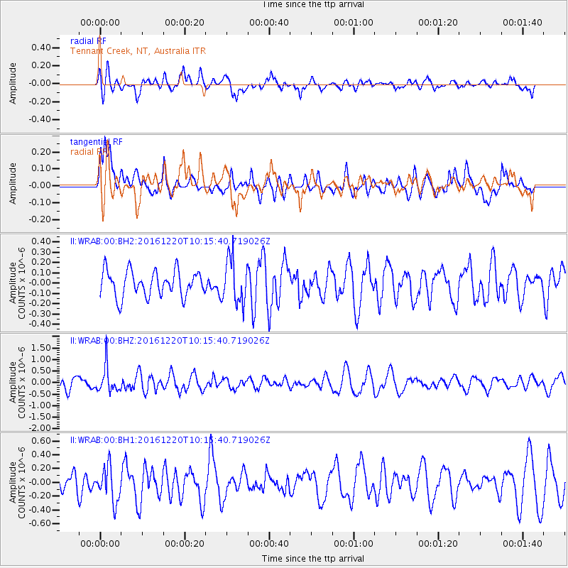
WRAB Tennant Creek, NT, Australia - Earthquake Result Viewer
*The percent match for this event was below the threshold and hence no stack was calculated.
| Earthquake location: |
Southern Xinjiang, China |
| Earthquake latitude/longitude: |
37.2/85.0 |
| Earthquake time(UTC): |
2016/12/20 (355) 10:04:39 GMT |
| Earthquake Depth: |
10 km |
| Earthquake Magnitude: |
5.6 mb |
| Earthquake Catalog/Contributor: |
NEIC PDE/us |
|
| Network: |
II Global Seismograph Network (GSN - IRIS/IDA) |
| Station: |
WRAB Tennant Creek, NT, Australia |
| Lat/Lon: |
19.93 S/134.36 E |
| Elevation: |
366 m |
|
| Distance: |
73.4 deg |
| Az: |
131.82 deg |
| Baz: |
320.739 deg |
| Ray Param: |
$rayparam |
*The percent match for this event was below the threshold and hence was not used in the summary stack. |
|
| Radial Match: |
56.48335 % |
| Radial Bump: |
400 |
| Transverse Match: |
66.69842 % |
| Transverse Bump: |
400 |
| SOD ConfigId: |
1894071 |
| Insert Time: |
2017-01-03 10:05:39.894 +0000 |
| GWidth: |
2.5 |
| Max Bumps: |
400 |
| Tol: |
0.001 |
|
Signal To Noise
| Channel | StoN | STA | LTA |
| II:WRAB:00:BHZ:20161220T10:15:40.719026Z | 2.5819678 | 5.647239E-7 | 2.1871843E-7 |
| II:WRAB:00:BH1:20161220T10:15:40.719026Z | 1.4723116 | 2.579964E-7 | 1.752322E-7 |
| II:WRAB:00:BH2:20161220T10:15:40.719026Z | 1.7582563 | 2.1788236E-7 | 1.2391956E-7 |
| Arrivals |
| Ps | |
| PpPs | |
| PsPs/PpSs | |


