F05A White Salmon, WA, USA - Earthquake Result Viewer
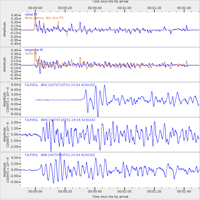
Earthquake location: Near West Coast Of Honshu, Japan
Earthquake latitude/longitude: 37.5/138.4
Earthquake time(UTC): 2007/07/16 (197) 01:13:22 GMT
Earthquake Depth: 12 km
Earthquake Magnitude: 6.5 MB, 6.4 MS, 6.6 MW, 6.5 MW
Earthquake Catalog/Contributor: WHDF/NEIC
Network: TA USArray Transportable Network (new EarthScope stations)
Station: F05A White Salmon, WA, USA
Lat/Lon: 45.88 N/121.46 W
Elevation: 455 m
Distance: 70.3 deg
Az: 46.918 deg
Baz: 303.777 deg
Ray Param: 0.055058327
Estimated Moho Depth: 33.75 km
Estimated Crust Vp/Vs: 2.10
Assumed Crust Vp: 6.597 km/s
Estimated Crust Vs: 3.145 km/s
Estimated Crust Poisson's Ratio: 0.35
Radial Match: 92.04977 %
Radial Bump: 400
Transverse Match: 87.14227 %
Transverse Bump: 400
SOD ConfigId: 2564
Insert Time: 2010-03-07 02:17:23.936 +0000
GWidth: 2.5
Max Bumps: 400
Tol: 0.001

Signal To Noise

ChannelStoNSTALTA
TA:F05A: :BHN:20070716T01:24:04.424016Z4.9422593.6803792E-77.446755E-8
TA:F05A: :BHE:20070716T01:24:04.424016Z5.5107966.9183693E-71.255421E-7
TA:F05A: :BHZ:20070716T01:24:04.424016Z36.4907262.3542018E-66.451507E-8
Arrivals
Ps5.8 SECOND
PpPs15 SECOND
PsPs/PpSs21 SECOND