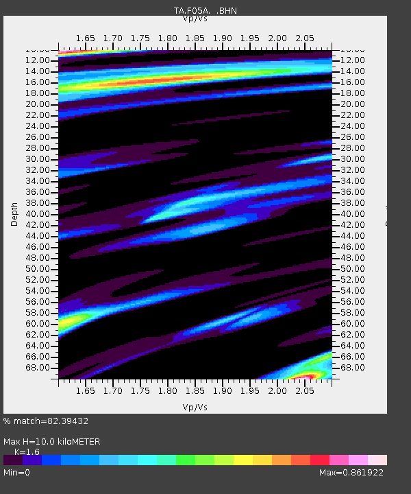
F05A White Salmon, WA, USA - Earthquake Result Viewer
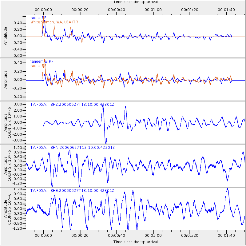
Earthquake location: Off Coast Of Chiapas, Mexico
Earthquake latitude/longitude: 15.0/-94.2
Earthquake time(UTC): 2006/06/27 (178) 13:03:12 GMT
Earthquake Depth: 29 km
Earthquake Magnitude: 5.4 MB, 5.5 MS, 5.8 MW, 5.8 MW
Earthquake Catalog/Contributor: WHDF/NEIC
Network: TA USArray Transportable Network (new EarthScope stations)
Station: F05A White Salmon, WA, USA
Lat/Lon: 45.88 N/121.46 W
Elevation: 455 m
Distance: 38.4 deg
Az: 328.979 deg
Baz: 134.514 deg
Ray Param: 0.07552877
Estimated Moho Depth: 10.0 km
Estimated Crust Vp/Vs: 1.60
Assumed Crust Vp: 6.597 km/s
Estimated Crust Vs: 4.123 km/s
Estimated Crust Poisson's Ratio: 0.18
Radial Match: 82.39432 %
Radial Bump: 377
Transverse Match: 73.12068 %
Transverse Bump: 331
SOD ConfigId: 2665
Insert Time: 2010-03-07 02:17:58.267 +0000
GWidth: 2.5
Max Bumps: 400
Tol: 0.001

Signal To Noise

ChannelStoNSTALTA
TA:F05A: :BHN:20060627T13:10:00.42301Z2.54672556.2790673E-72.4655452E-7
TA:F05A: :BHE:20060627T13:10:00.42301Z1.88782543.1033028E-71.6438506E-7
TA:F05A: :BHZ:20060627T13:10:00.42301Z6.7919571.8143788E-62.671364E-7
Arrivals
Ps1.0 SECOND
PpPs3.6 SECOND
PsPs/PpSs4.6 SECOND