F05A White Salmon, WA, USA - Earthquake Result Viewer
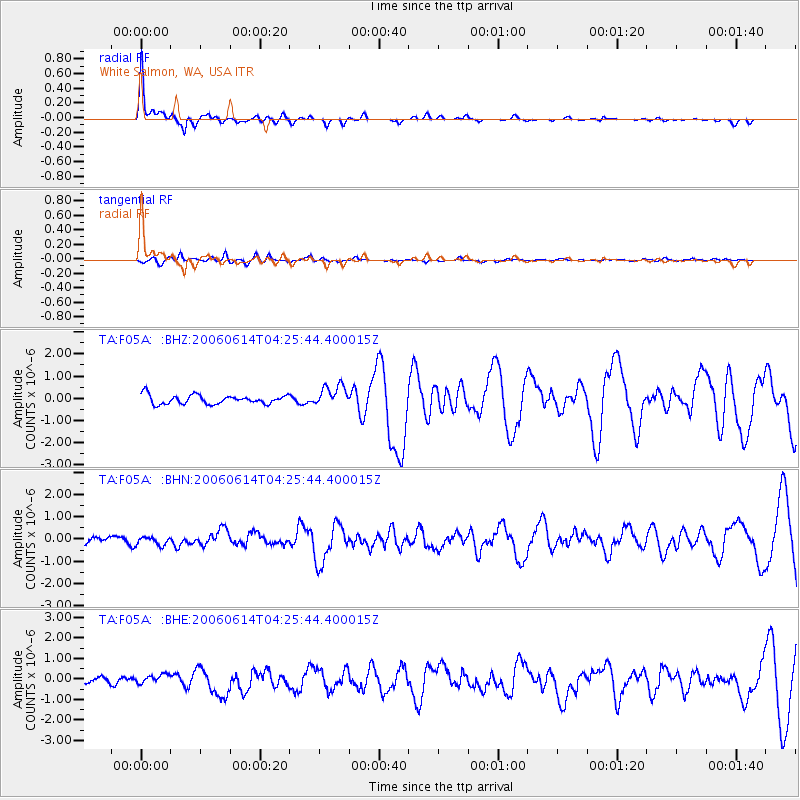
Earthquake location: Rat Islands, Aleutian Islands
Earthquake latitude/longitude: 51.8/177.1
Earthquake time(UTC): 2006/06/14 (165) 04:18:42 GMT
Earthquake Depth: 14 km
Earthquake Magnitude: 5.9 MB, 6.4 MS, 6.4 MW, 6.4 MW
Earthquake Catalog/Contributor: WHDF/NEIC
Network: TA USArray Transportable Network (new EarthScope stations)
Station: F05A White Salmon, WA, USA
Lat/Lon: 45.88 N/121.46 W
Elevation: 455 m
Distance: 39.8 deg
Az: 73.359 deg
Baz: 301.499 deg
Ray Param: 0.074746795
Estimated Moho Depth: 12.5 km
Estimated Crust Vp/Vs: 2.03
Assumed Crust Vp: 6.597 km/s
Estimated Crust Vs: 3.254 km/s
Estimated Crust Poisson's Ratio: 0.34
Radial Match: 86.672966 %
Radial Bump: 306
Transverse Match: 66.70857 %
Transverse Bump: 400
SOD ConfigId: 5745
Insert Time: 2010-03-07 02:18:00.038 +0000
GWidth: 2.5
Max Bumps: 400
Tol: 0.001

Signal To Noise

ChannelStoNSTALTA
TA:F05A: :BHN:20060614T04:25:44.400015Z1.21400641.8398006E-71.5154785E-7
TA:F05A: :BHE:20060614T04:25:44.400015Z1.66688762.4774815E-71.4862918E-7
TA:F05A: :BHZ:20060614T04:25:44.400015Z2.3712534.786264E-72.0184537E-7
Arrivals
Ps2.1 SECOND
PpPs5.4 SECOND
PsPs/PpSs7.5 SECOND