You are here: Home > Network List > GS - US Geological Survey Networks Stations List
> Station OK051 E0350 and S34600 Roads, Ralston, OK > Earthquake Result Viewer
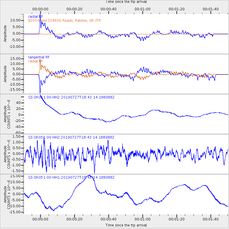
OK051 E0350 and S34600 Roads, Ralston, OK - Earthquake Result Viewer
*The percent match for this event was below the threshold and hence no stack was calculated.
| Earthquake location: |
Near S. Coast Of Honshu, Japan |
| Earthquake latitude/longitude: |
33.1/137.3 |
| Earthquake time(UTC): |
2019/07/27 (208) 18:31:07 GMT |
| Earthquake Depth: |
367 km |
| Earthquake Magnitude: |
6.3 Mww |
| Earthquake Catalog/Contributor: |
NEIC PDE/us |
|
| Network: |
GS US Geological Survey Networks |
| Station: |
OK051 E0350 and S34600 Roads, Ralston, OK |
| Lat/Lon: |
36.51 N/96.84 W |
| Elevation: |
263 m |
|
| Distance: |
94.2 deg |
| Az: |
40.914 deg |
| Baz: |
317.004 deg |
| Ray Param: |
$rayparam |
*The percent match for this event was below the threshold and hence was not used in the summary stack. |
|
| Radial Match: |
70.26454 % |
| Radial Bump: |
400 |
| Transverse Match: |
67.676 % |
| Transverse Bump: |
400 |
| SOD ConfigId: |
19053131 |
| Insert Time: |
2019-08-10 18:37:46.269 +0000 |
| GWidth: |
2.5 |
| Max Bumps: |
400 |
| Tol: |
0.001 |
|
Signal To Noise
| Channel | StoN | STA | LTA |
| GS:OK051:00:HHZ:20190727T18:43:14.188988Z | 2.059054 | 7.963403E-7 | 3.867506E-7 |
| GS:OK051:00:HH1:20190727T18:43:14.188988Z | 3.2612767 | 1.1577089E-5 | 3.549864E-6 |
| GS:OK051:00:HH2:20190727T18:43:14.188988Z | 1.6907043 | 2.8791792E-5 | 1.7029464E-5 |
| Arrivals |
| Ps | |
| PpPs | |
| PsPs/PpSs | |


