You are here: Home > Network List > TA - USArray Transportable Network (new EarthScope stations) Stations List
> Station R32K Eaglecrest, AK, USA > Earthquake Result Viewer
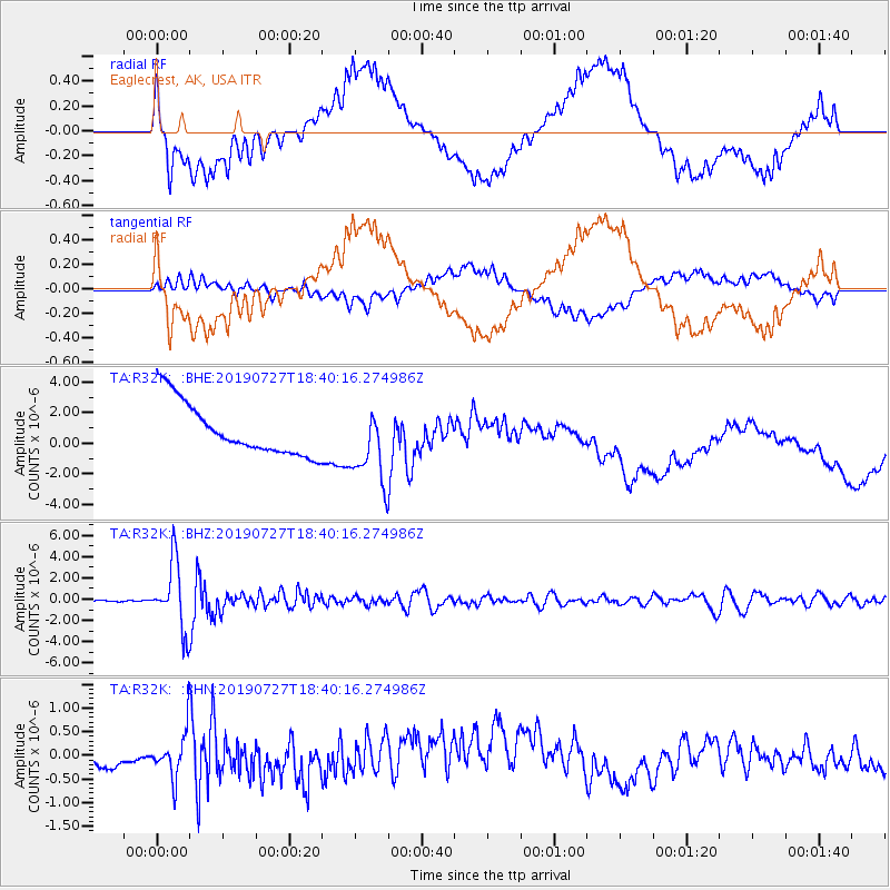
R32K Eaglecrest, AK, USA - Earthquake Result Viewer
*The percent match for this event was below the threshold and hence no stack was calculated.
| Earthquake location: |
Near S. Coast Of Honshu, Japan |
| Earthquake latitude/longitude: |
33.1/137.3 |
| Earthquake time(UTC): |
2019/07/27 (208) 18:31:07 GMT |
| Earthquake Depth: |
367 km |
| Earthquake Magnitude: |
6.3 Mww |
| Earthquake Catalog/Contributor: |
NEIC PDE/us |
|
| Network: |
TA USArray Transportable Network (new EarthScope stations) |
| Station: |
R32K Eaglecrest, AK, USA |
| Lat/Lon: |
58.27 N/134.52 W |
| Elevation: |
386 m |
|
| Distance: |
61.6 deg |
| Az: |
36.915 deg |
| Baz: |
287.517 deg |
| Ray Param: |
$rayparam |
*The percent match for this event was below the threshold and hence was not used in the summary stack. |
|
| Radial Match: |
45.25262 % |
| Radial Bump: |
400 |
| Transverse Match: |
44.636444 % |
| Transverse Bump: |
400 |
| SOD ConfigId: |
19053131 |
| Insert Time: |
2019-08-10 18:43:04.266 +0000 |
| GWidth: |
2.5 |
| Max Bumps: |
400 |
| Tol: |
0.001 |
|
Signal To Noise
| Channel | StoN | STA | LTA |
| TA:R32K: :BHZ:20190727T18:40:16.274986Z | 44.36062 | 3.1576742E-6 | 7.118193E-8 |
| TA:R32K: :BHN:20190727T18:40:16.274986Z | 2.6996882 | 4.765424E-7 | 1.7651756E-7 |
| TA:R32K: :BHE:20190727T18:40:16.274986Z | 1.4180512 | 2.4143324E-6 | 1.7025706E-6 |
| Arrivals |
| Ps | |
| PpPs | |
| PsPs/PpSs | |


