You are here: Home > Network List > US - United States National Seismic Network Stations List
> Station HAWA Hanford, Washington, USA > Earthquake Result Viewer
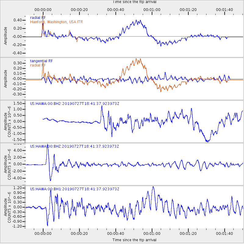
HAWA Hanford, Washington, USA - Earthquake Result Viewer
*The percent match for this event was below the threshold and hence no stack was calculated.
| Earthquake location: |
Near S. Coast Of Honshu, Japan |
| Earthquake latitude/longitude: |
33.1/137.3 |
| Earthquake time(UTC): |
2019/07/27 (208) 18:31:07 GMT |
| Earthquake Depth: |
367 km |
| Earthquake Magnitude: |
6.3 Mww |
| Earthquake Catalog/Contributor: |
NEIC PDE/us |
|
| Network: |
US United States National Seismic Network |
| Station: |
HAWA Hanford, Washington, USA |
| Lat/Lon: |
46.39 N/119.53 W |
| Elevation: |
364 m |
|
| Distance: |
74.9 deg |
| Az: |
44.28 deg |
| Baz: |
302.193 deg |
| Ray Param: |
$rayparam |
*The percent match for this event was below the threshold and hence was not used in the summary stack. |
|
| Radial Match: |
67.96832 % |
| Radial Bump: |
400 |
| Transverse Match: |
78.10455 % |
| Transverse Bump: |
400 |
| SOD ConfigId: |
19053131 |
| Insert Time: |
2019-08-10 18:44:14.404 +0000 |
| GWidth: |
2.5 |
| Max Bumps: |
400 |
| Tol: |
0.001 |
|
Signal To Noise
| Channel | StoN | STA | LTA |
| US:HAWA:00:BHZ:20190727T18:41:37.923973Z | 59.859028 | 2.8024888E-6 | 4.681815E-8 |
| US:HAWA:00:BH1:20190727T18:41:37.923973Z | 7.4464216 | 5.213208E-7 | 7.000958E-8 |
| US:HAWA:00:BH2:20190727T18:41:37.923973Z | 4.8450117 | 4.926475E-7 | 1.0168137E-7 |
| Arrivals |
| Ps | |
| PpPs | |
| PsPs/PpSs | |


