You are here: Home > Network List > US - United States National Seismic Network Stations List
> Station WMOK Wichita Mountains, Oklahoma, USA > Earthquake Result Viewer
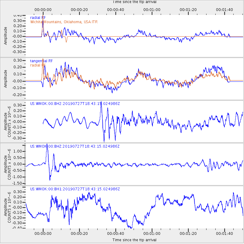
WMOK Wichita Mountains, Oklahoma, USA - Earthquake Result Viewer
*The percent match for this event was below the threshold and hence no stack was calculated.
| Earthquake location: |
Near S. Coast Of Honshu, Japan |
| Earthquake latitude/longitude: |
33.1/137.3 |
| Earthquake time(UTC): |
2019/07/27 (208) 18:31:07 GMT |
| Earthquake Depth: |
367 km |
| Earthquake Magnitude: |
6.3 Mww |
| Earthquake Catalog/Contributor: |
NEIC PDE/us |
|
| Network: |
US United States National Seismic Network |
| Station: |
WMOK Wichita Mountains, Oklahoma, USA |
| Lat/Lon: |
34.74 N/98.78 W |
| Elevation: |
486 m |
|
| Distance: |
94.4 deg |
| Az: |
43.285 deg |
| Baz: |
315.698 deg |
| Ray Param: |
$rayparam |
*The percent match for this event was below the threshold and hence was not used in the summary stack. |
|
| Radial Match: |
48.04579 % |
| Radial Bump: |
400 |
| Transverse Match: |
40.482624 % |
| Transverse Bump: |
400 |
| SOD ConfigId: |
19053131 |
| Insert Time: |
2019-08-10 18:44:24.227 +0000 |
| GWidth: |
2.5 |
| Max Bumps: |
400 |
| Tol: |
0.001 |
|
Signal To Noise
| Channel | StoN | STA | LTA |
| US:WMOK:00:BHZ:20190727T18:43:15.024986Z | 10.995792 | 7.1113004E-7 | 6.4672925E-8 |
| US:WMOK:00:BH1:20190727T18:43:15.024986Z | 1.774905 | 2.2483644E-7 | 1.266752E-7 |
| US:WMOK:00:BH2:20190727T18:43:15.024986Z | 2.4520164 | 1.6296654E-7 | 6.6462256E-8 |
| Arrivals |
| Ps | |
| PpPs | |
| PsPs/PpSs | |


